
The Best Local Hike in Western Massachusetts
Everything you need to know about the best local gem hike in Western Mass…

Tekoa’s rocky ledge viewpoint is Western Massachusetts’ best-kept secret. Read on to find out how to get here.
One of the top reasons on my list for wanting to move to Western Massachusetts was for the outdoor adventuring. Growing up in a suburb of Dallas, hiking looked like going to local park and exploring the woods. It was a great way to pass a Saturday afternoon (and who can complain about time spent outdoors/), but I craved more. I wanted longer trails. Elevation gain. Summit views.
Western Mass has this hidden beauty that only those who visit will ever uncover. Most people who visit Massachusetts frequent Boston or the Cape. There’s a running joke up here that Worcester is Western Massachusetts to Bostonians. Very few take the scenic drive out to what I consider to be the real gem of the state.
I may be biased, but Western Mass has it all—from outdoorsy adventures to breweries, to easy access to day trips. In the six years I have resided here, I frequent many of the same trails. In the last year, however, I discovered countless new ones. My all-time favorite? Tekoa Mountain. And here’s why.
Tekoa is something special.
It’s not easily accessible. It’s not a walk in the woods like many Western Mass favorites. It’s immersed in nature. Untouched, it feels like. Overgrown at times. Rarely do I see other hikers on this mountain despite its beauty.
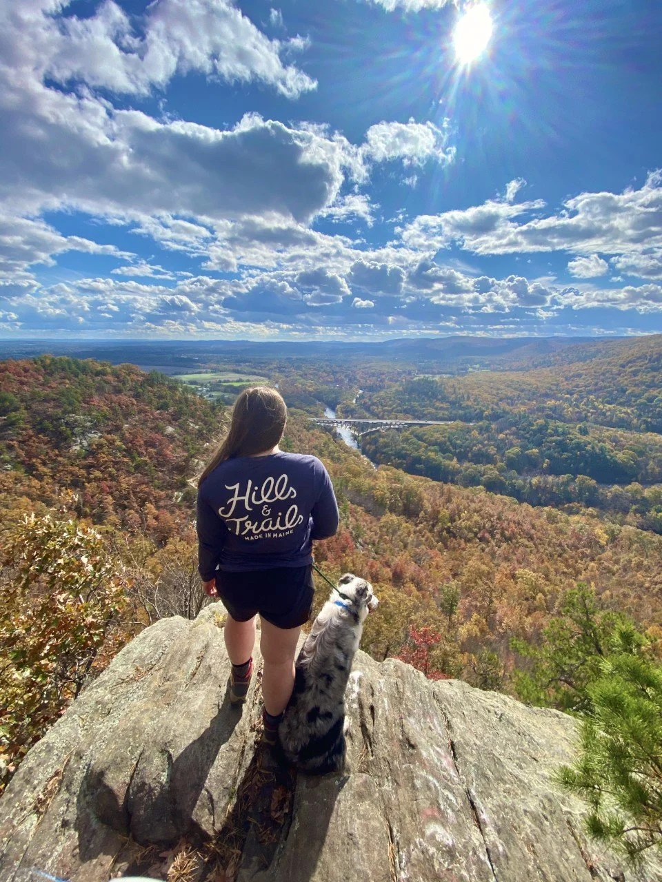
I first stumbled upon it on a solo drive to upstate New York. Everyone driving to that area of New York on the Mass Pike crosses over a bridge that showcases encompassing valley views. Yes, that bridge you see way down there in the images above.
If you’re able to glance long enough, you notice a rocky ledge on the upper righthand side. After I caught sight of it for the first time, I made a mental note of the town I was driving through (Russell, MA), and researched it as soon as I could. Want to know what I found?

Nothing.
No trail maps, no trail reviews—nothing on AllTrails, and that says something.
I found a few comments about a steep route up that involved a sketchy parking situation that I was not keen on venturing into. I put off the search for a couple years and decided to try again last fall. I lucked out after some digging and found a legal parking spot. With a little trial, some error, and a sprinkle of wrong turns, I finally found my favorite outdoor gem in Western Massachusetts and it sure was worth the wait.
Everything you need to know about hiking to the ledge atop Tekoa Mountain:
Parking – This is the trickiest part. The safest parking I found is along a residential road that ends with a gate that the town needs access to. There is room for about five cars to avoid blocking the gate. I plug in 48 Reservoir Road, Westfield, MA into Google Maps. This is technically in the town of Montgomery, but it will show up as Westfield. Once you’re on this quiet road, drive to the end. Park there. Again, be sure to not block the gate.
Cost – Free!
Distance – About 5 miles out-and-back with a little over 1,000 feet elevation gain. There is an option to make a loop at the summit for a sunset view and different vantage point of the valley (with a little bushwhacking involved). If I could do it as a beginner bushwhacker, so can you! Sunset technically can’t be seen from the ledge, so this loop is great if you want that sunbeam shining through.
Difficulty – The reason this hike is my absolute favorite (and a Western Massachusetts hidden gem) is because most people think they need to travel a far distance for a tougher hike. I was one of those people, so I totally get it. What I love about this hike is that it’s local, peaceful, and has a climb. I love those short, easy hikes as much as the next hiker, but there’s something to be said for putting in the work and getting the payout once you reach the summit.

The route I take (logged on Strava) is above. From the parking to the viewpoint as an out-and-back.
Trail Details – After parking on Reservoir Road, follow the road behind the gate for a little under half a mile. It’s a steady, slight climb on a wide, gravel road. Veer left at the half mile mark and you’ll approach a gorgeous view atop a bridge of the Tekoa Reservoir. The calming stream and serene surroundings provides a great opportunity to catch your breath and enjoy the scenery.
When you’re ready, continue onwards and upwards. You’ll reach a Y intersection. Take the right, even though there’s a very official-looking sign on the left (it’s an informational sign). It’s not the direction you want for this hike.
Coming up is one of the best parts of this hike: the climb. After you turn right, you’ll follow along Moose Meadow Brook until you’re about a mile in. Here’s where I’ve gone astray far too many times. As you approach a mile, keep your eyes peeled for a left turn off the road into a dirt trail. It’s easy to miss if you’re deep in conversation, trail running, or just enjoying your hike. You’ll know you went too far if you cross another scenic bridge at a mile in. This bridge is great, but it means you missed the turn.
Once you’re in the woods, a gorgeous, well-trekked walk along a stream before the climb kicks in around a mile and a half in awaits you. This is one of my favorite parts of this hike because I have yet to come across anyone on this trail. It’s just the sound of the stream, the chirping of birds, and me. And my thoughts of bear encounters flooding in, of course. The first big climb of the hike flattens out for a tenth of a mile before beginning the final ascent to the ridgeline. Continue following the yellow markers. Though I usually see chipmunks or squirrels on this hike, I saw a bear for the first time here in May.

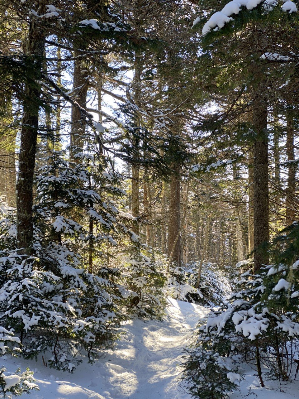
Tekoa in Winter
After one lovely dumping of snow, I knew I had to get out on the trail up Tekoa. It definitely did not disappoint. Snowshoes would have been a smart choice considering how infrequently traversed this trail is.
Depending on the season, the trail here is not maintained well. Be sure to bring bug spray or wear long pants to avoid any fun bug or plant reactions.
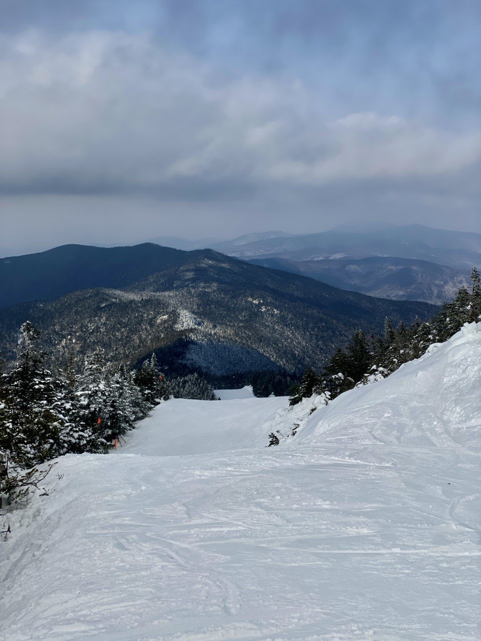
Once you finish that second, steep climb, you will find your trail opens up like a T. There are red markers here to remind you to take this trail back. Take a left and follow the yellow markers until you reach the summit. There are a few rolling hills and some rusty car parts along the way.
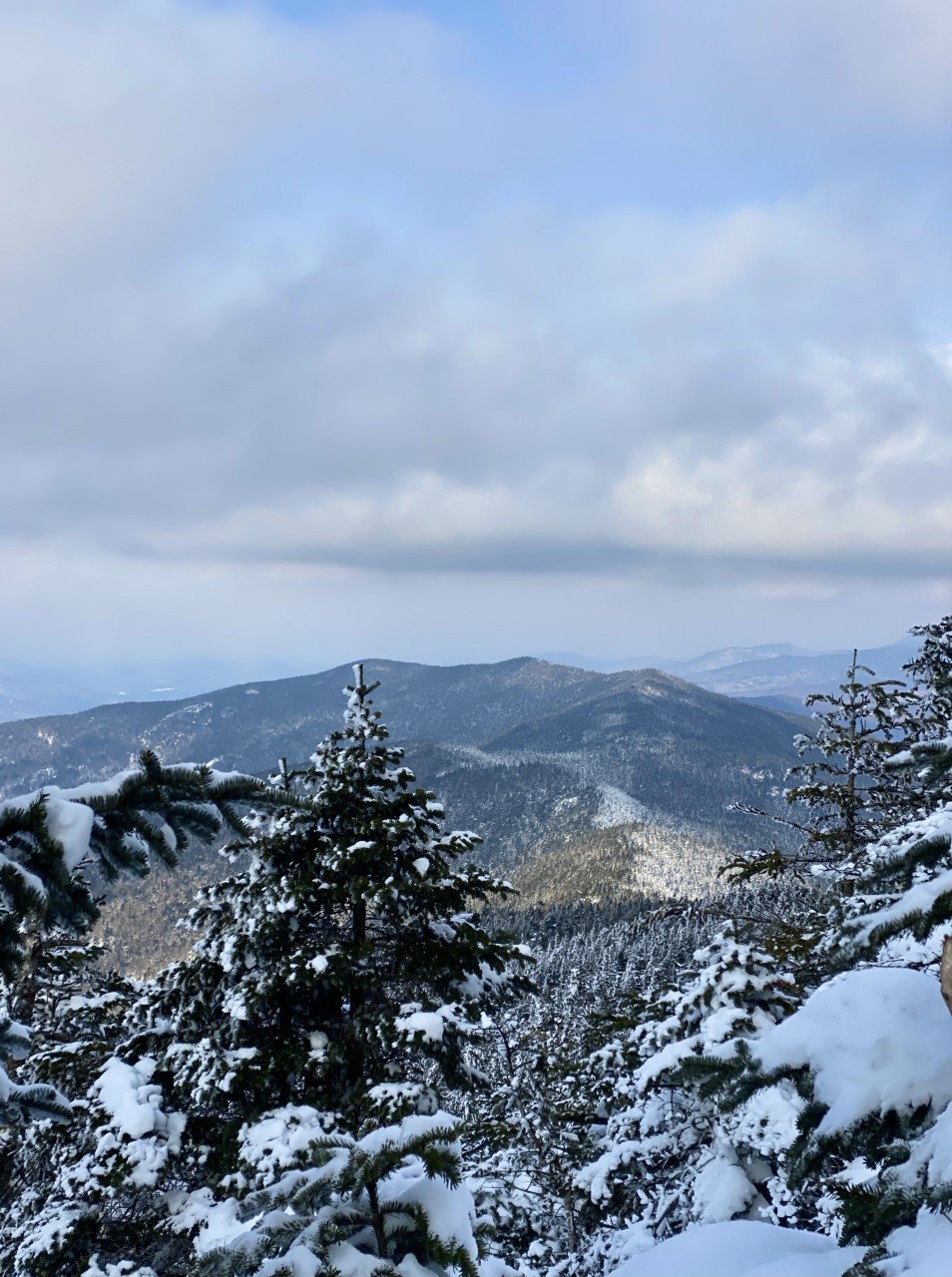
The viewpoint is approached from a wide clearing at the top with distant views of Springfield to your left. Take the trail to the right of the rock pile to reach the iconic, rocky ledge view you may have seen from the Mass Pike.
As always, please leave no trace. Whatever you bring onto the hike, please take back out with you to ensure this local gem stays beautiful for everyone.

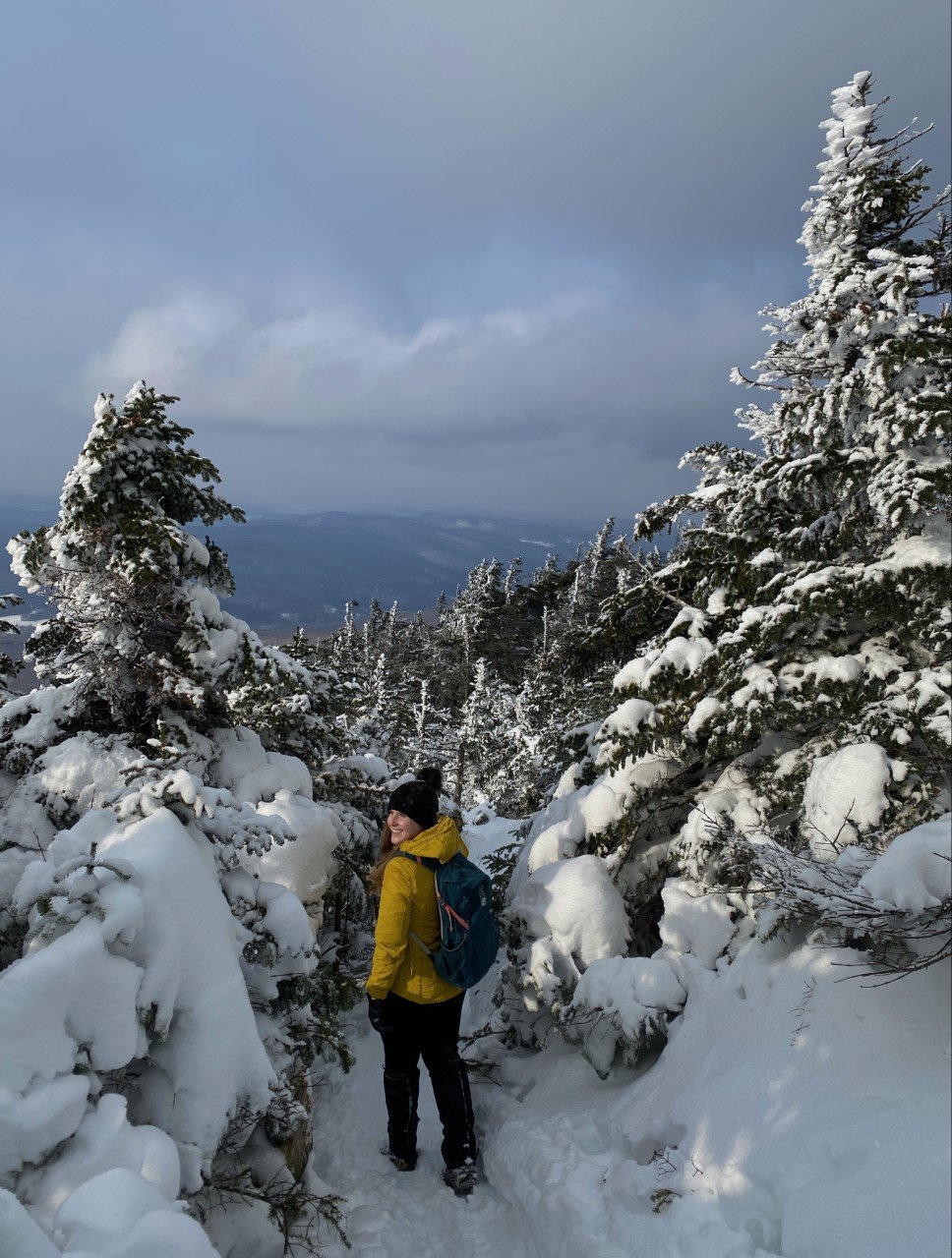
You really cannot go wrong with any season you choose to accomplish this hike in. From foliage in the fall, to snow-capped hills in the winter, to the luscious greenery of spring — the constancy of a great view remains unchanged.
Tip: This is an incredible spot for sunset, and though the trail itself is not maintained well in terms of overgrowth, the trail markers have reflective stickers on them. For someone who is easily distracted in nature, I found these stickers so helpful with my headlamp even while trail running post-sunset.
What makes your favorite hike your favorite? Are you adding Tekoa to your list of must do hikes in Massachusetts? I’d love to know!
If you’re looking for more New England hikes and gems, you’ll enjoy:

Hike the Vermont 5 4,000 Footers Challenge
New England hikers love a good list. Check out Vermont’s 5 highest peaks:

New England hikers love a good list. There’s the 48 in New Hampshire, the 14 in Maine, and the 5 in Vermont. If you’re extra adventurous, there’s the 46 in the Adirondacks in New York to complete for the Northeast list.
After finishing my 48 in the White Mountains in New Hampshire in 2020, I focused my efforts on smaller mountains in Lake Placid with the Lake Placid 9. In 2022, I reset my focus on 4,000 footers.
I decided to tackle the Vermont 5.
I actually hiked one of the Vermont 4,000 footers back in 2016 and then never hiked in Vermont again, despite several visits to the state’s charming towns. I ran races around hilly Stowe and set my eyes on Mt. Mansfield, but hadn’t hiked it yet.
At the start of 2022, I realized I could easily hike the four remaining 4,000 footers. Here’s how I took on the Vermont 5 in winter:
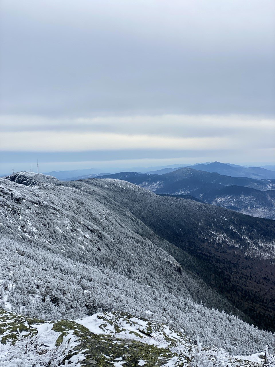
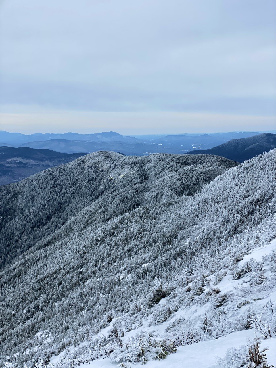
1. Camel’s Hump (4,083 ft)

I technically hiked this one in November before the official winter season, but let me tell you it sure felt like winter! My first year in New England, my friend invited me to Burlington, VT for the weekend and told me to pack hiking gear. This looked like my thickest cotton and basic hiking boots. I’m serious. Check out the pictures in this post if you don’t believe me.
We took the Monroe Trail out-and-back for six miles and around 2,500 ft gain. The views were absolutely breathtaking (could’ve also been the wild winds that took my breath away). I was hooked on winter hiking after this one. 360-degree views of the Green Mountains with a nice decent.

2. Killington Peak (4,235 ft)
This peak may have a reputation for incredible skiing and stunning views, but I couldn’t tell you if either are true after my hike. I was the only hiker on New Year’s Day at the parking lot. Excited to spend the start of the year outside, but nervous about the conditions.
As I embarked on the Bucklin trail, my worries dissipated. The trail was a moderate climb. Slowly and steadily, I ascended. Surprised by the sweat dripping down in the crevices of my arm as I gripped my backpack straps on my way up. Equally surprising? The hail that began to hit me like Monday morning’s alarm. I reminded myself that this was what winter was in the mountains of New England: a three-course meal ensuring your tongue had a little taste of everything. And I sure was hungry for it.
I spent very little time at the summit considering the hail, along with the incoming text informing me of the weather advisory in the area. It was also a complete wash, so that didn’t quite entice me to stay for the view. The way down was a speedy one. I ended with 6.85 miles logged and 2,559 ft of elevation gain on the out-and-back trail.
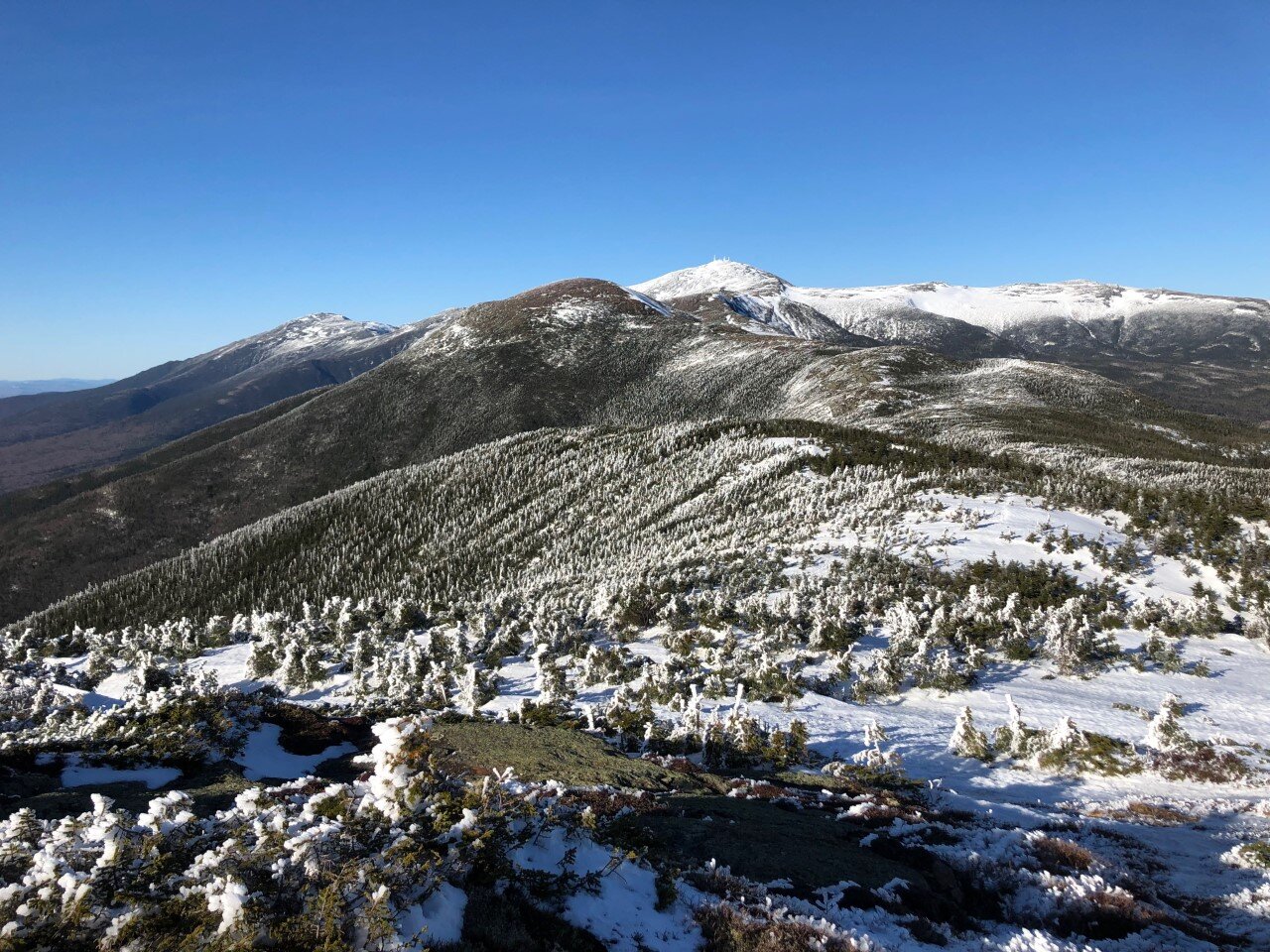
3. Mt. Abraham (4,006 ft)
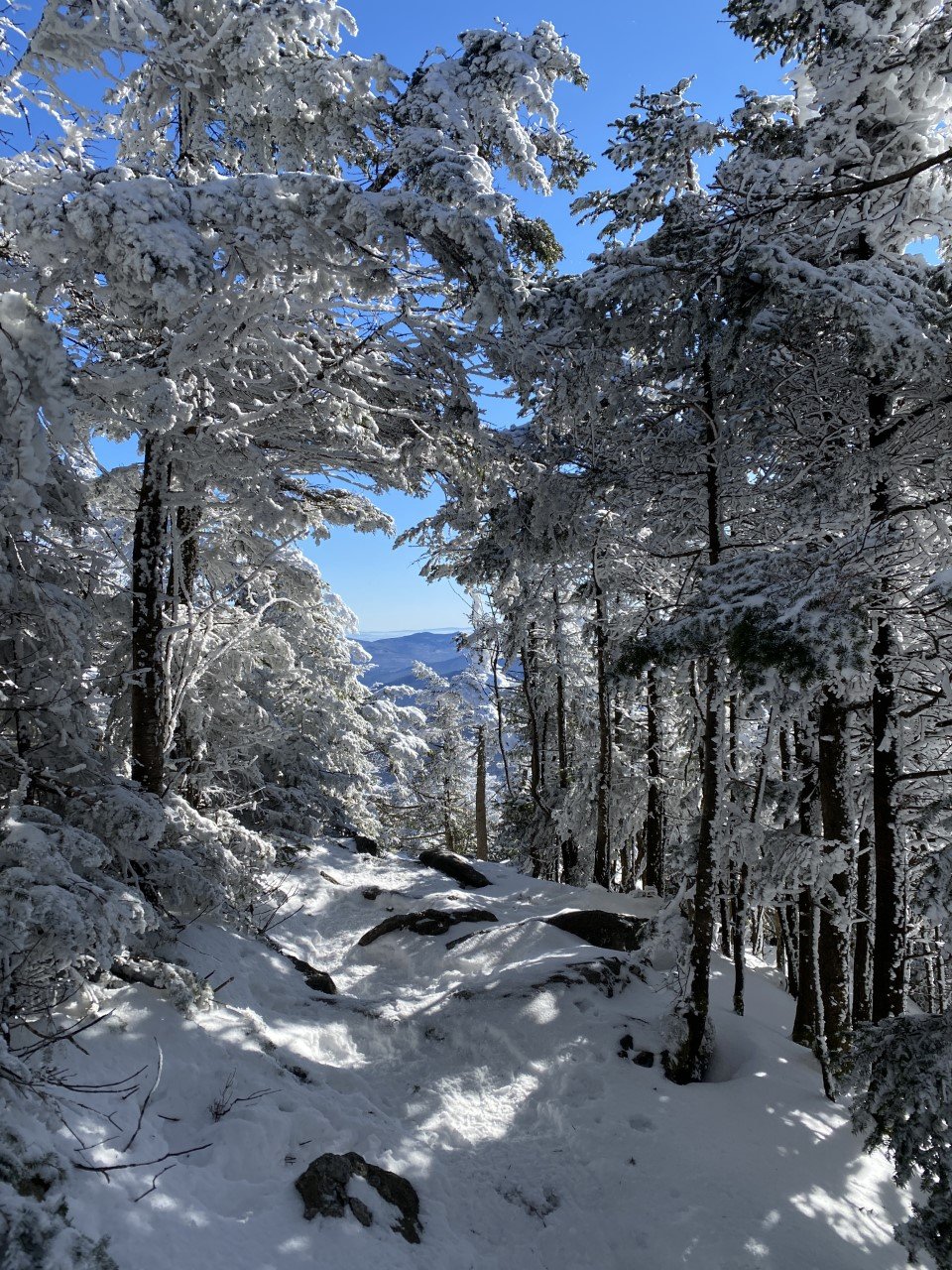
I spent this winter eyeing the forecast like it was another one of my part-time jobs. With full-time teaching and marathon training on my schedule, there were only a handful of days that even allowed for a Vermont day trip. Let alone a day where the winds weren’t treacherous. Pro tip: I use Mountain Forecast to plan out my hikes. On the website, type the mountain you’re hoping to climb, and it gives you everything you need to know to make a smart decision: temperature, wind chill, wind miles per hour. All of it for the summit. I can’t tell you the number of times I went hiking when I was a beginner that I’d rely on my iPhone’s weather app and solely look up the small New Hampshire mountain town my hike started in.
I learned pretty quickly that the weather in town isn’t necessarily on the same communication channel. While it’s sunny and warm in town, it can easily be the complete opposite atop the summit.
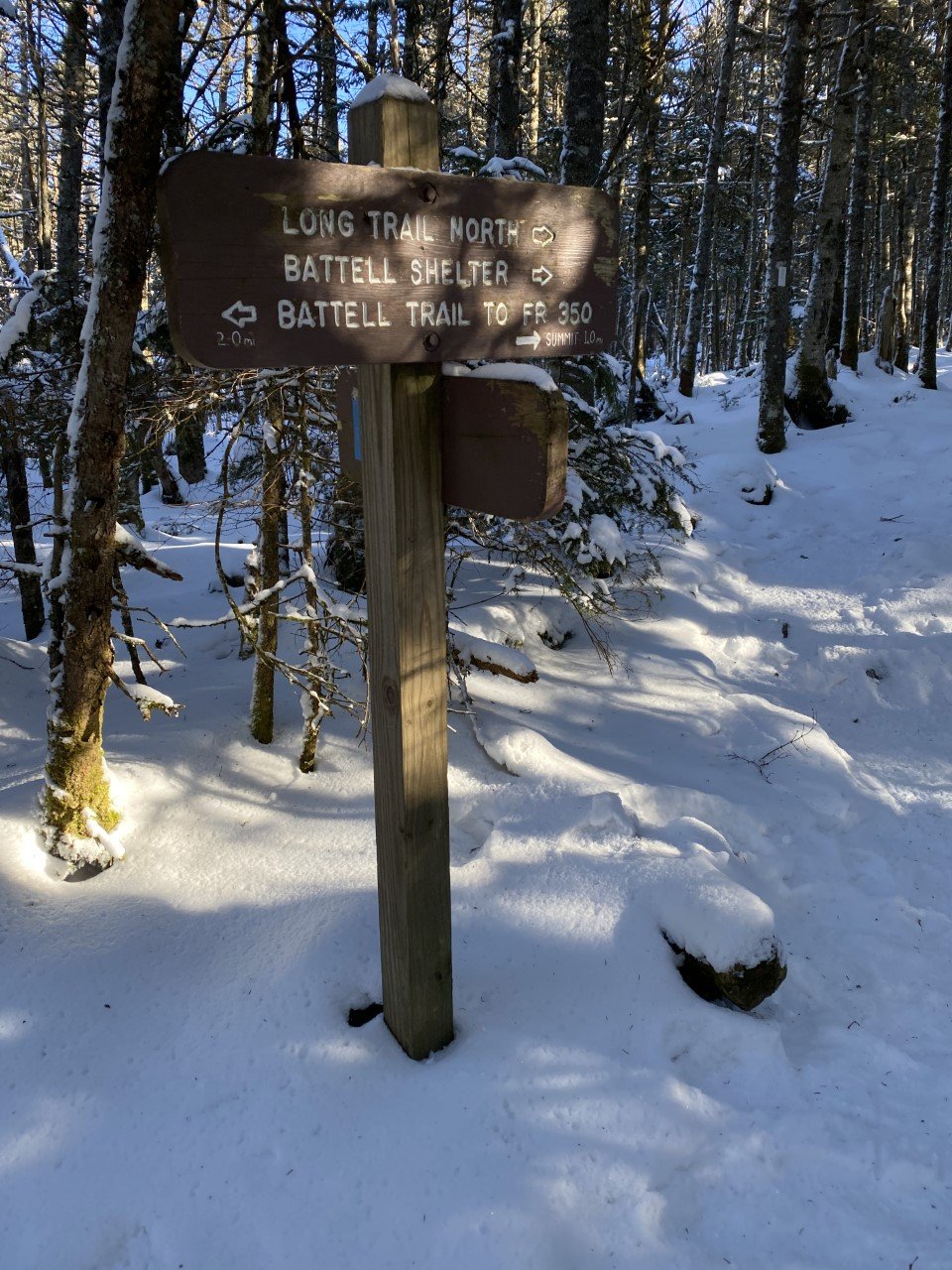
I found easy parking along Elder Hill Road, but I assume it was due to winter dissuading the average hiker from weekend adventuring. From Elder Hill Road, the Battell trail is quick to spot. Another speedy one thanks to packed down snow, I took Battell to the end when it formed into the Long Trail.
Lincoln Gap Road has a shorter distance hike to the summit, but in winter this road is closed. Regardless, Battell is roughly a six mile out-and-back. The summit offers scaping views of the Green Mountains. There is an old airplane (remnants of a crash) along the summit ridgeline, but with all the snow at the time, I didn’t come across it. Always need to leave a reason to revisit though, right?

Summit views from Abraham.
With the parking lot in sight, I logged 5.84 miles and 2,700 ft of climbing total.
4. Mt. Ellen (4,083 ft)
When I parked on Jim Dwire Road, I thought I would be the only one out on the trail today. I almost missed the trail sign because it blended in so well. There were a few cars parked on the side of the road that indicated I was indeed, in the right place. A small dirt road on a residential street, why would I find anything strange with that?
As I made my way to the tiny sliver of trail from the trail sign, I thought about the week before when I was on the opposite side of these mountains. After such a great day meeting Abraham, I could hardly wait to meet Ellen. However, Abraham didn’t relay the memo to Ellen to pack down the fresh, fluffy powder for me.
It took me quite some time to make my way to the summit as I didn’t have snowshoes. I called Ellen just about every name other than her own as I struggled to the summit. The sun was setting soon and the temperature was dropping. I made it to the summit, only to be met with skiers swiftly speeding past me.
After a moment to enjoy the view, I raced against the daylight (usually a losing battle in winter) to return to my car before the sun called it a night. At 7.11 miles roundtrip and 2,700 ft ascended, I can confidently say I met Ellen, but she wasn’t my favorite.
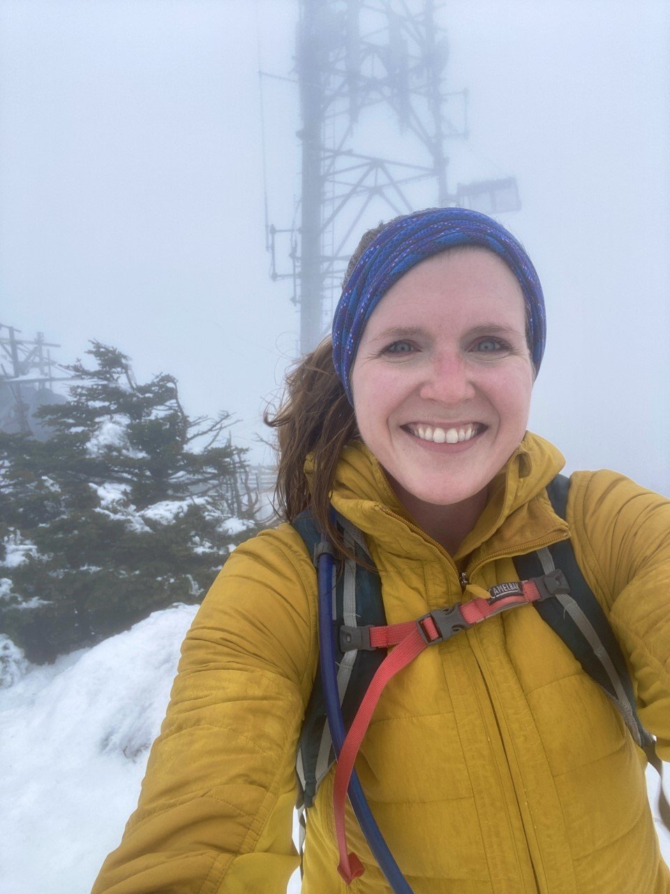
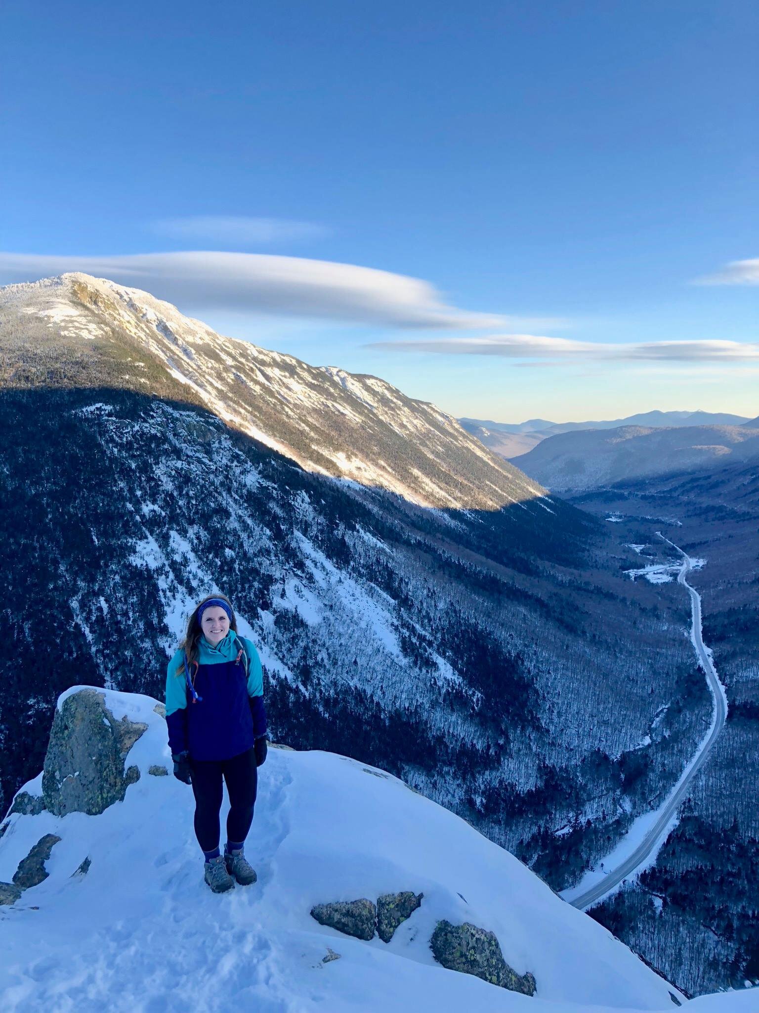
5. Mt. Mansfield (4,393 ft)

Mt. Mansfield for the big finale felt fitting. As the tallest peak in the tiny state of Vermont, I wanted a clear day at the summit. I watched the forecasts and my training plan schedule, and finally found an opening in March that let me head up Mansfield.
I parked on Mountain Road in Underhill State Park and began my steady climb along another road that isn’t maintained in winter. The road was a decent climb, but quiet. I took the CCC road with a quick shortcut thanks to the Eagles Cut trail to get me onto the trail I set out for: Sunset Ridge.
Sunset Ridge is definitely a gem of a trail. There is plenty of exposure on the trail with a little rock scrambling. Normally I love that, but with some wild winds, I was nervous about taking this trail down. Sunset Ridge joins with the Long Trail near the summit for a totally exposed view of the Green Mountains, including a nearby ski lift. I had the trail that day (and the summit) to myself, and it felt like such a great way to finish off hiking the highest peaks in Vermont.
When it came to descending, my heart sank contemplating returning Sunset Ridge with how windy and exposed it was. However out of the two trails (Sunset Ridge and Laura Cowles) from Underhill State Park, Sunset was less steep.
A seasoned hiker told me to take Laura Cowles (the steeper, tougher trail) down and I’m so glad I listened! I was originally worried of exposure descending Laura Cowles, but that trail, from the summit, quickly turns forested. Before I realized, I made my way down to the road and logged 6.6 miles and 3,130 ft of climbing.
Have you hiked any of Vermont’s highest peaks? Would you take on the VT 5?
Newcomers to Solo Hiking: 6 Perfect New Hampshire Hikes to Take on Alone
One of the perks of teaching is having the month of July off to travel. I spent one July a few summers ago living in southern New Hampshire with a friend. I was so pumped to live near the Whites, even though I had only hiked the Franconia Ridge a year earlier.
With my new proximity to the Whites, I set my sights on hiking. The only problem? My friend spent the summer working, so I was on my own. I had no problem traveling alone or exploring new places by myself, but hiking in unknown terrain with limited cell signal was not a habit of mine. How things would change in the coming years…
I didn’t hike a 4,000 footer once that summer. I was too afraid of the what if’s.
I look back now and regret how close I was to the mountains and how I didn’t take advantage of them. I did spend that July starting out what would later be a weekend regular: hiking alone in the Whites.
I researched short hikes that were clearly marked. I wanted to leave no room for error. Here are the hikes I did that summer (along with a few extras I did later on) that are ideal for first-time adventurers, low-on timers, beginner hikers, or short-on-hiking-pals trekkers:

1. West Rattlesnake Mountain
A 2-mile hike with a little less than 500 ft elevation gain. Beautiful any time of day or year with this view of Squam Lake.

2. Artist’s Bluff
Less than half a mile to this beautiful overlook in the heart of the Whites in Franconia Notch with a bit of a steep incline. I’ve been here a handful of times and the view never gets old.

3. Mt. Willard
Another fan favorite in Franconia Notch is this beautiful 3 mile, out-and-back trail. Perfect for all levels and a jaw-dropping view every time.

3. Mt. Willard (continued)
Same view, different season. A major perk of winter hiking is less hikers along the trail. I hiked Willard with a friend a couple years ago in negative temps and we only crossed paths with a set of hikers at the summit.

4. Welch-Dickey Loop
This was my first attempt at prepping for 4,000 footers. Welch-Dickey is a loop of a little over 4 miles with a little under 2,000 ft gain.
This was also my first experience with NH’s namesake as the granite state, which I experienced in rainy conditions. I wouldn’t recommend this hike in running shoes on a rainy day.

5. Mt. Major
Another under-5 mile hike loop outside the Whites with stunning views. This hike is pretty popular any time of year, so it’s ideal for new solo hikers.
6. Mt. Pierce
A 4,000 footer that you can totally handle. Though this wasn’t my first 4ker, it was the first one I hiked alone. I spent an April break in the mountains and Pierce was first on my list. Three miles up to the summit on a bluebird day led to me bag Eisenhower nearby in the same day, but Pierce alone is well worth the trek.
It is one of the NH 48 with a little over 2,000 ft elevation gain. The climb is well-paced and there are endless views of the presidentials at the summit, including good ol’ Washington.
Have you made it to any of these summits? Which ones do you plan to add to your list? Let me know if you’re going to tackle these summits soon.