
Three Hikes in One Day in Virginia’s Shenandoah National Park
Here are three hikes you can take on in one day’s visit to Shenandoah National Park, including a bonus secret sunset spot:

The always stunning Appalachian Mountains from Shenandoah National Park.
In January, I noticed I had a three-day weekend without any work obligations. Naturally, to me, that means an adventure needs to be planned. I set my eyes on Shenandoah, a place I spent a day in years ago and always hoped to revisit.
Shenandoah, and Virginia in general, often feels overlooked. A hidden gem of a place, like the New River Gorge in West Virginia.
I rarely have the opportunity to visit a national park in the off-season, and of course took total advantage. From Massachusetts, Shenandoah is a 7.5 hour drive, or about eight with a gas and bathroom break stop. I took the more scenic route through the middle-of-nowhere Pennsylvania to take advantage of the lack of traffic on a Friday afternoon start of the long weekend.
Since I was planning so last minute, I didn’t set any plans for my time there. My best kept secret for lodging is booking a cabin stay at a KOA. It felt meant to be when there was one vacant cabin left at the Harrisonburg/Shenandoah KOA. Of course I had to book it. With my rewards points, my three-night stay was very affordable.
These cabins are my favorite because they’re rustic chic. It’s a definite upgrade from a tent (or sleeping in my car if we’re honest), but it’s not lavish by any means.
After my long drive, I slept in. I prepared some coffee and breakfast on the porch of my cabin, and promptly ate it inside because it turns out, Virginia gets cold. Like New England cold.
I packed several layers thinking I would not need them, but ultimately used a lot of my cold weather gear when I went hiking. Always read what park rangers in Shenandoah National Park post about the most up-to-date information on alerts and conditions in the park. Skyline Drive can be entirely (or partially) shut down due to icy conditions.

Shenandoah National Park Wildlife
The only memory I really have from my first trip to Shenandoah is a rocky summit hike I did with dad, but this was quickly overshadowed by my first bear sighting. We caught sight of a bear cub about twenty yards from us and hastened our pace back to the parking lot. Lo and behold, momma bear was on the road.
It was truly a spectacle. That I enjoyed from inside our car because I did not need to be any closer to the bear than I already had been.
It was time to make new memories in Shenandoah, so I embarked on a few hikes. Here are three hikes you can take on in one day’s visit to Shenandoah National Park:
1. Bearfence Mountain
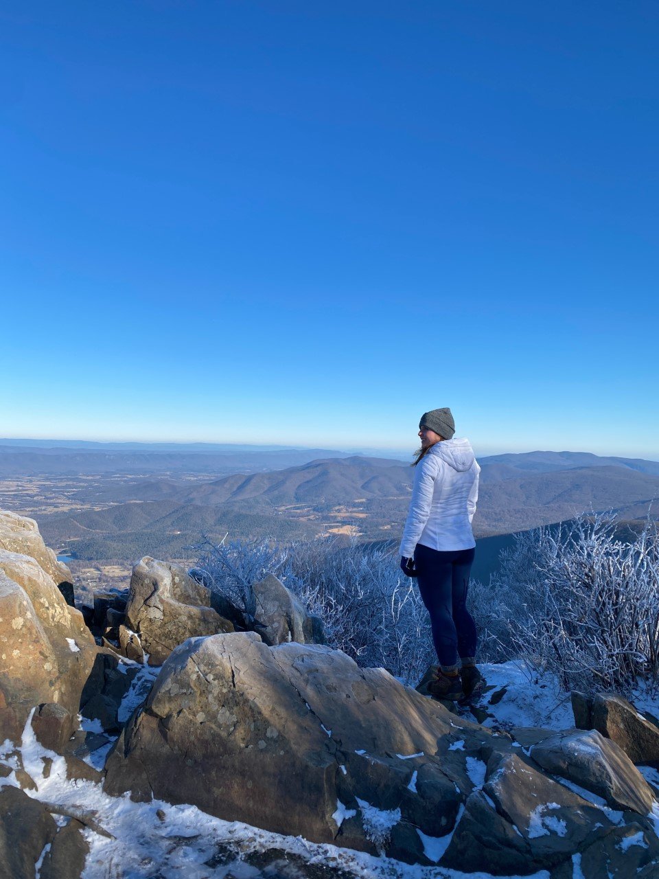
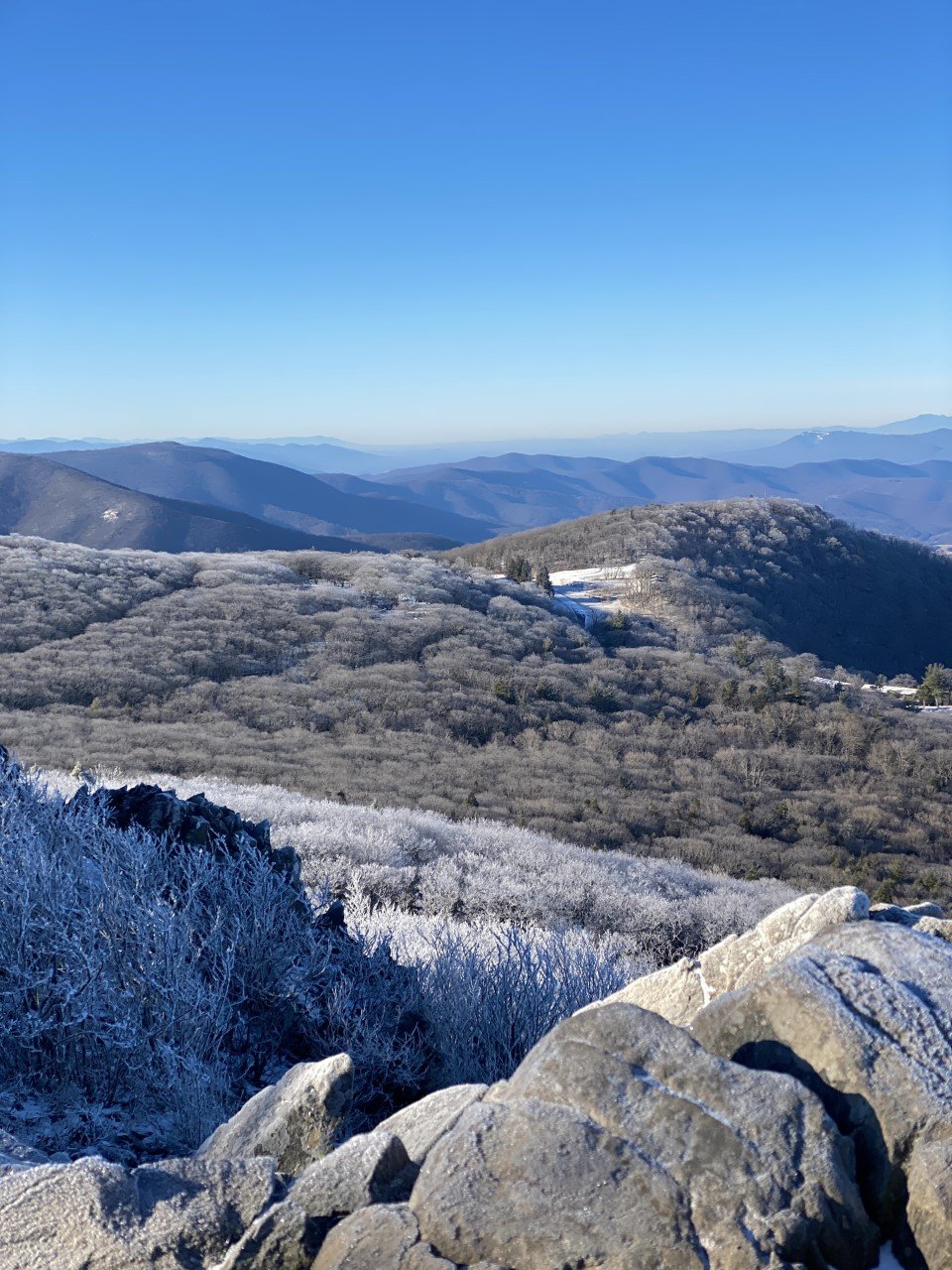
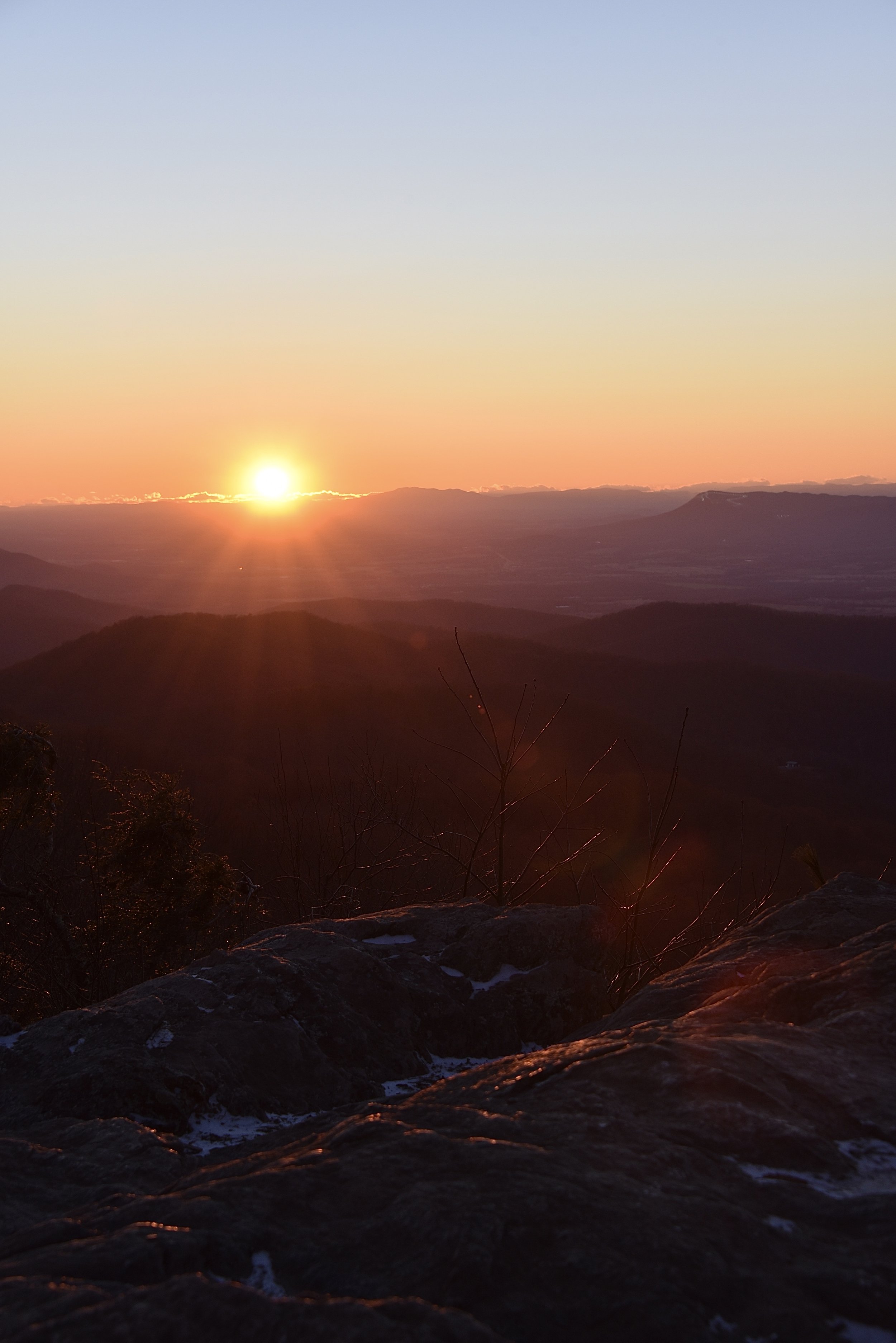
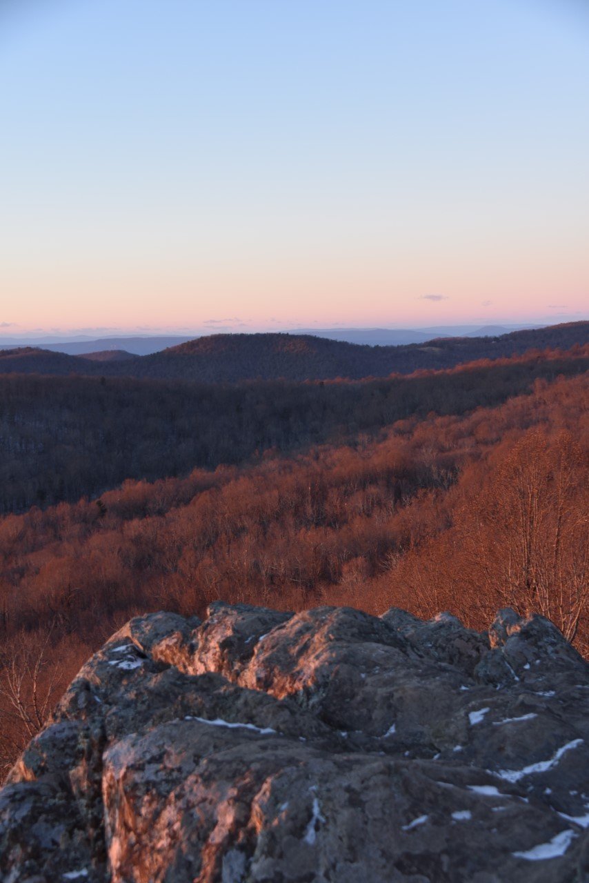
I took full advantage of the off-season and arrived to the park before sunrise to start my day with the sun atop a summit. The best spot to catch sunrise is Bearfence Mountain. Here’s a secret: you don’t have to make it past the icy ledges to the actual summit for breathtaking, 365-degree views.

The first light on a winter morning without a car or other hiker in sight for a couple hours in the park.
I was the only one in the parking lot, at milepost (MP) 56.4 when I arrived at 7 A.M. As soon as I turned off the ignition and crossed the road to the trailhead, I remembered this was the hike I did with my dad seven years ago. The one where I saw the momma bear on the road. A fitting mountain name for this hike. As much as I love seeing wildlife, I was hoping I wouldn’t come across a bear this time around.
The trail was icy, and as always, I’m racing against the sun. I made it up about .3 miles and around 275 feet of elevation when the wind really kicked in at one of the false summits. I was alone and cold, but couldn’t wait for the sun to rise.
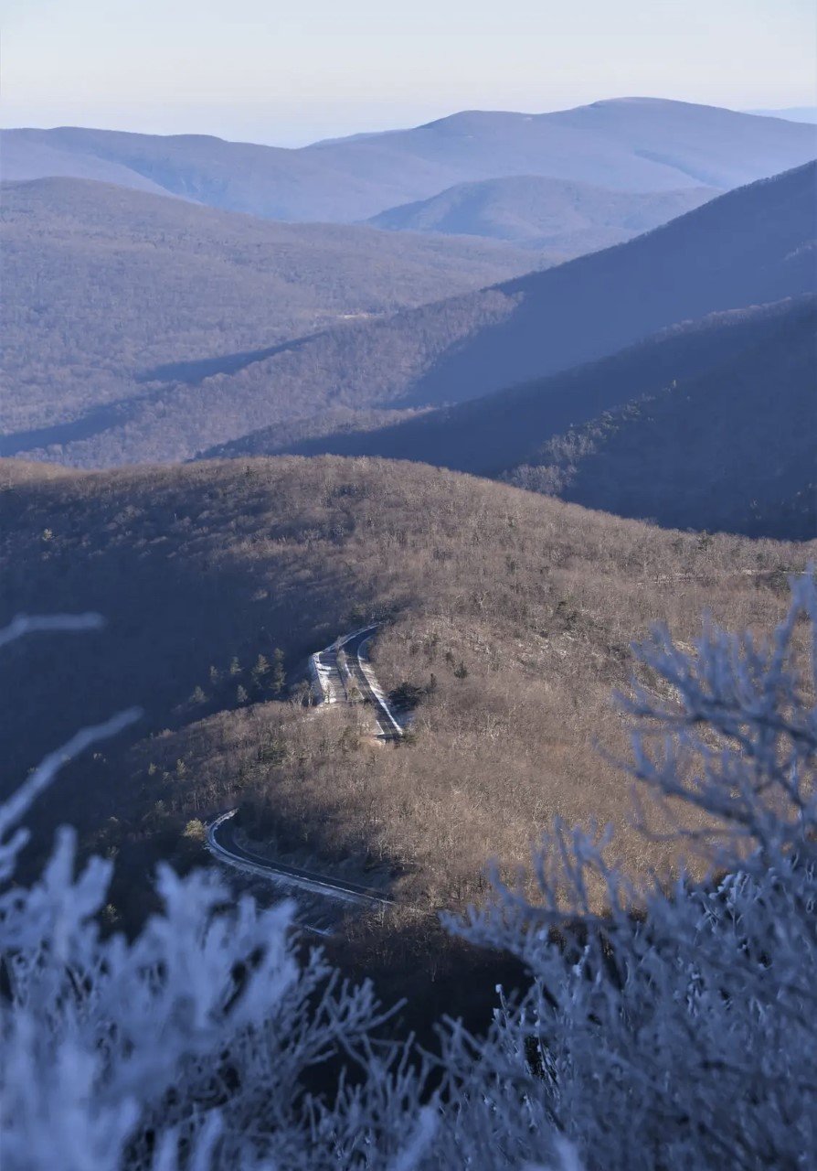
The summit was a bit further out, along a little more of a rocky, iced ridgeline. I decided it was best to camp where I was and enjoy the start of the day from where I was. This hike is also one of the few hikes in all of Shenandoah National Park where you catch a glimpse of Skyline Drive from a bird’s-eye-view. I love a good road photo surrounded by nature.
But what I truly loved, was feeling like I was the only person for miles on this mountain watching the sun rise. Sunrises really are the best.
When I could no longer feel my fingers, despite my gloves and hand warmers, I headed down the same way I went up. Confident as always, I ate it on one of the last steps before I made it to the road. Just Shenandoah reminding me to humble myself.

The route from Strava
Here’s the route I took. At the end of the trail, I looked at the trail map and realized there is a way to avoid the icy, rocky ridgeline that I stopped short of by hiking on the Appalachian Trail instead. Next time (and if I wake up early enough)!
2. Hawksbill Mountain
When you finish soaking up the first light to hit the Appalachian Mountains of Virginia, it’s time to head to a Shenandoah favorite, rightly so.

Shenandoah really has it figured out with all of its rocky ledges.
Right off Shenandoah National Park’s main park road, Skyline Drive, is the trail for Hawksbill at MP 45.6.

The route for Hawksbill Mountain
This hike was so nice I had to do it twice. One of my favorite aspects about it is that the summit reaches over 4,000 feet. I didn’t know any hikes further south from Massachusetts hit 4,000 feet, considering Massachusetts’ highest peak, Mt. Greylock, comes in at 3,490 feet.
In about one mile and only 500 feet of climbing, I was met with a windy, icy summit reminiscent of New Hampshire’s wintry peaks.
3. Stony Man Mountain
Stony Man was a quick jaunt, but worthwhile to see the Appalachian Mountains from a different perspective.
As the day begins to near the late afternoon, it’s time to make moves to catch sunset. You have two incredible options for sunset: one is to hike up Stony Man Mountain for jaw-dropping views of the Appalachian Mountains. Another, if you’re tired (or short on time), is to pull over at one of the overlooks and take a hidden trail to a secluded ledge. More on both options below.
A great trail leading right off of Skyline Drive is Stony Man Mountain. The parking lot is at MP 41.7. I had little to no service in the park, so I relied on the park map provided to me by the park rangers upon entering the park, as well as downloaded trail maps from AllTrails. There is also a Little Stony Man, so be sure to go for the big guy. This hike traverses the Appalachian Trail, which I loved, because it again reminded me of home back in New England.

The Strava route for Stony Man Mountain
A speedy three-quarters of a mile to the summit with roughly 300 feet of climbing brought me to this scenic spot. The other major perk of the off-season? Parking lots, trails, and summits entirely to myself. I loved every minute of it!
I would hike up Stony Man for sunset because it is short, has ample parking, and of course, the views.
Bonus Sunset Spot: The Point Overlook (MP 55.5)
If you’re short on time, or exhausted from a day full of hiking, check out MP (milepost) 55.5. Pull over and park at The Point Overlook right off Skyline Drive. You’ll find a stone wall with an empty space in it. Walk through that empty spot down the trail, roughly 300 feet.
You’ll be greeted with a rocky ledge all to yourself. I parked at The Point Overlook with two other cars, but neither party ventured on this hidden path. It’s definitely worthwhile, especially if you are short on time to run up a mountain.
Which hike is making it to your list? Would you take on all three in one day?
If you enjoyed learning about this national park, then you’ll love exploring these:
3 Hours in Kentucky’s Best-Kept Secret: Mammoth Cave NP
Two Must-Do Experiences in Florida (No, Not Disney)
The Best Time of Year to Visit White Sands National Park, New Mexico
3 Colorado National Parks To Visit (That Aren’t Rocky Mountain!)
7 Lessons I Learned Road-Tripping Across the U.S.
Visit America's Newest National Park: The New River Gorge, WV
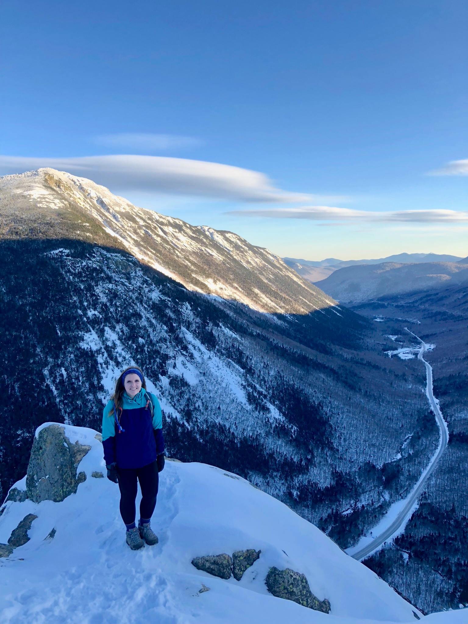
Newcomers to Solo Hiking: 6 Perfect New Hampshire Hikes to Take on Alone
One of the perks of teaching is having the month of July off to travel. I spent one July a few summers ago living in southern New Hampshire with a friend. I was so pumped to live near the Whites, even though I had only hiked the Franconia Ridge a year earlier.
With my new proximity to the Whites, I set my sights on hiking. The only problem? My friend spent the summer working, so I was on my own. I had no problem traveling alone or exploring new places by myself, but hiking in unknown terrain with limited cell signal was not a habit of mine. How things would change in the coming years…
I didn’t hike a 4,000 footer once that summer. I was too afraid of the what if’s.
I look back now and regret how close I was to the mountains and how I didn’t take advantage of them. I did spend that July starting out what would later be a weekend regular: hiking alone in the Whites.
I researched short hikes that were clearly marked. I wanted to leave no room for error. Here are the hikes I did that summer (along with a few extras I did later on) that are ideal for first-time adventurers, low-on timers, beginner hikers, or short-on-hiking-pals trekkers:

1. West Rattlesnake Mountain
A 2-mile hike with a little less than 500 ft elevation gain. Beautiful any time of day or year with this view of Squam Lake.

2. Artist’s Bluff
Less than half a mile to this beautiful overlook in the heart of the Whites in Franconia Notch with a bit of a steep incline. I’ve been here a handful of times and the view never gets old.

3. Mt. Willard
Another fan favorite in Franconia Notch is this beautiful 3 mile, out-and-back trail. Perfect for all levels and a jaw-dropping view every time.

3. Mt. Willard (continued)
Same view, different season. A major perk of winter hiking is less hikers along the trail. I hiked Willard with a friend a couple years ago in negative temps and we only crossed paths with a set of hikers at the summit.

4. Welch-Dickey Loop
This was my first attempt at prepping for 4,000 footers. Welch-Dickey is a loop of a little over 4 miles with a little under 2,000 ft gain.
This was also my first experience with NH’s namesake as the granite state, which I experienced in rainy conditions. I wouldn’t recommend this hike in running shoes on a rainy day.

5. Mt. Major
Another under-5 mile hike loop outside the Whites with stunning views. This hike is pretty popular any time of year, so it’s ideal for new solo hikers.
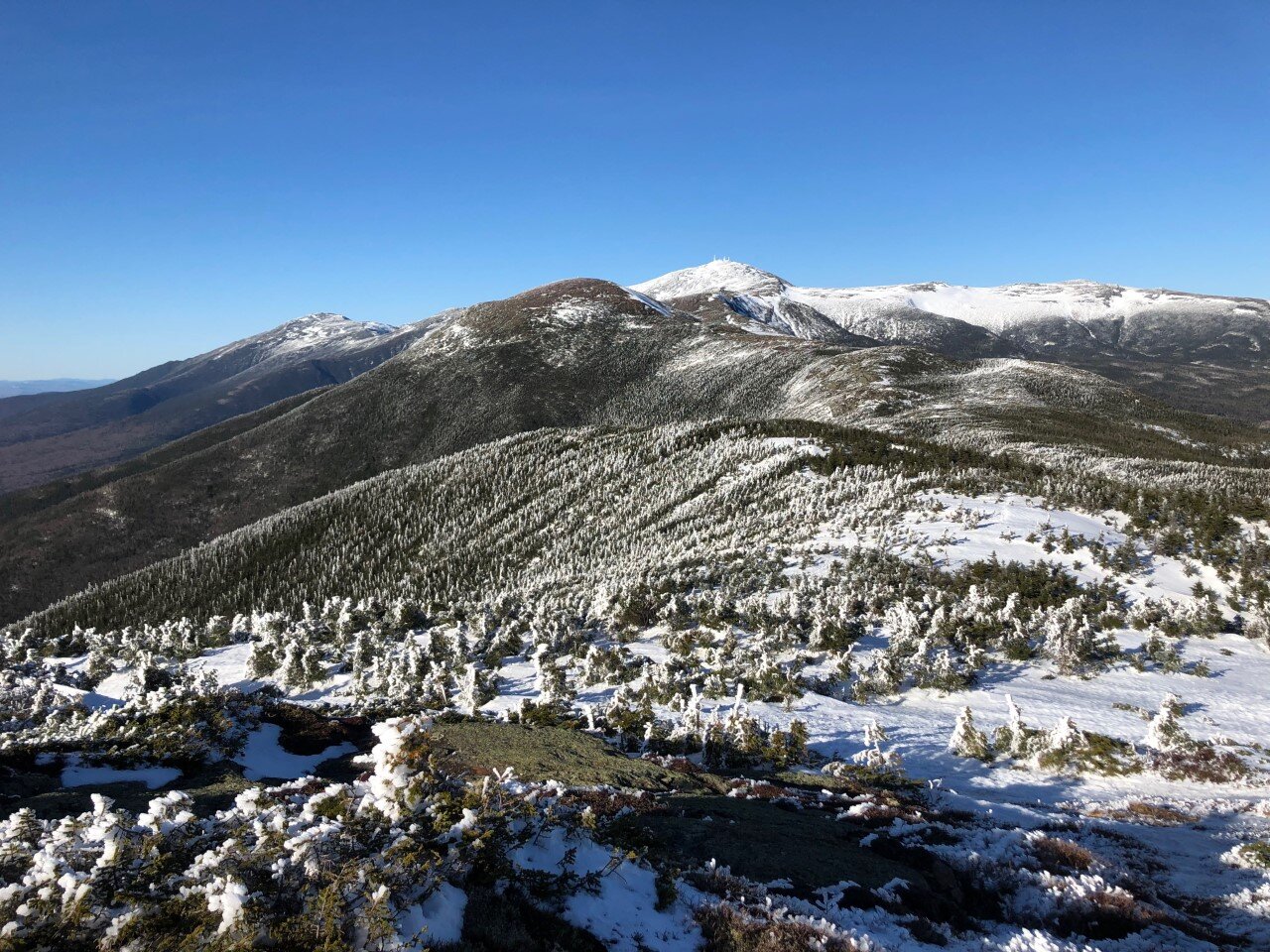
6. Mt. Pierce
A 4,000 footer that you can totally handle. Though this wasn’t my first 4ker, it was the first one I hiked alone. I spent an April break in the mountains and Pierce was first on my list. Three miles up to the summit on a bluebird day led to me bag Eisenhower nearby in the same day, but Pierce alone is well worth the trek.
It is one of the NH 48 with a little over 2,000 ft elevation gain. The climb is well-paced and there are endless views of the presidentials at the summit, including good ol’ Washington.
Have you made it to any of these summits? Which ones do you plan to add to your list? Let me know if you’re going to tackle these summits soon.