
Hike the Vermont 5 4,000 Footers Challenge
New England hikers love a good list. Check out Vermont’s 5 highest peaks:

New England hikers love a good list. There’s the 48 in New Hampshire, the 14 in Maine, and the 5 in Vermont. If you’re extra adventurous, there’s the 46 in the Adirondacks in New York to complete for the Northeast list.
After finishing my 48 in the White Mountains in New Hampshire in 2020, I focused my efforts on smaller mountains in Lake Placid with the Lake Placid 9. In 2022, I reset my focus on 4,000 footers.
I decided to tackle the Vermont 5.
I actually hiked one of the Vermont 4,000 footers back in 2016 and then never hiked in Vermont again, despite several visits to the state’s charming towns. I ran races around hilly Stowe and set my eyes on Mt. Mansfield, but hadn’t hiked it yet.
At the start of 2022, I realized I could easily hike the four remaining 4,000 footers. Here’s how I took on the Vermont 5 in winter:
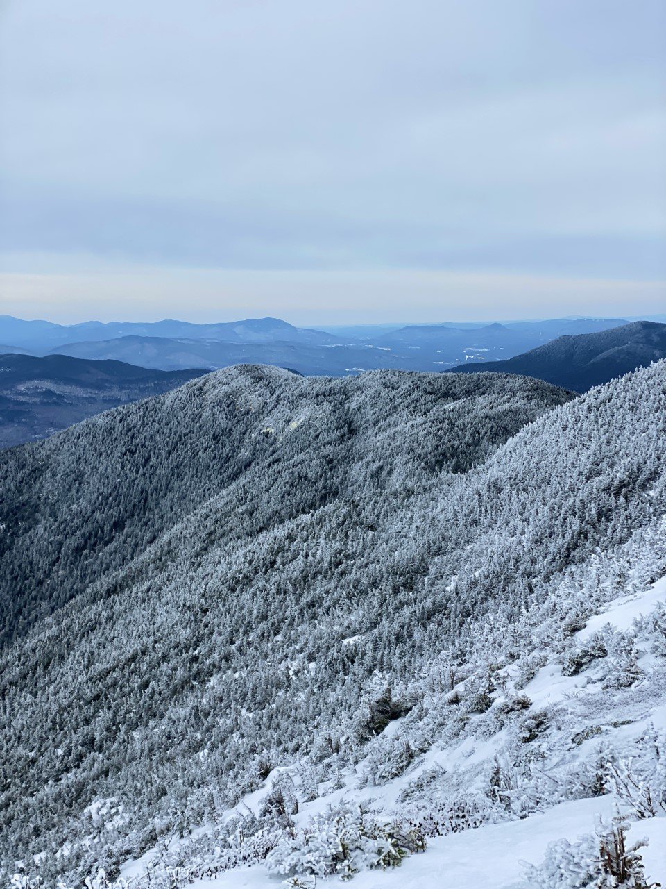
1. Camel’s Hump (4,083 ft)

I technically hiked this one in November before the official winter season, but let me tell you it sure felt like winter! My first year in New England, my friend invited me to Burlington, VT for the weekend and told me to pack hiking gear. This looked like my thickest cotton and basic hiking boots. I’m serious. Check out the pictures in this post if you don’t believe me.
We took the Monroe Trail out-and-back for six miles and around 2,500 ft gain. The views were absolutely breathtaking (could’ve also been the wild winds that took my breath away). I was hooked on winter hiking after this one. 360-degree views of the Green Mountains with a nice decent.

2. Killington Peak (4,235 ft)
This peak may have a reputation for incredible skiing and stunning views, but I couldn’t tell you if either are true after my hike. I was the only hiker on New Year’s Day at the parking lot. Excited to spend the start of the year outside, but nervous about the conditions.
As I embarked on the Bucklin trail, my worries dissipated. The trail was a moderate climb. Slowly and steadily, I ascended. Surprised by the sweat dripping down in the crevices of my arm as I gripped my backpack straps on my way up. Equally surprising? The hail that began to hit me like Monday morning’s alarm. I reminded myself that this was what winter was in the mountains of New England: a three-course meal ensuring your tongue had a little taste of everything. And I sure was hungry for it.
I spent very little time at the summit considering the hail, along with the incoming text informing me of the weather advisory in the area. It was also a complete wash, so that didn’t quite entice me to stay for the view. The way down was a speedy one. I ended with 6.85 miles logged and 2,559 ft of elevation gain on the out-and-back trail.
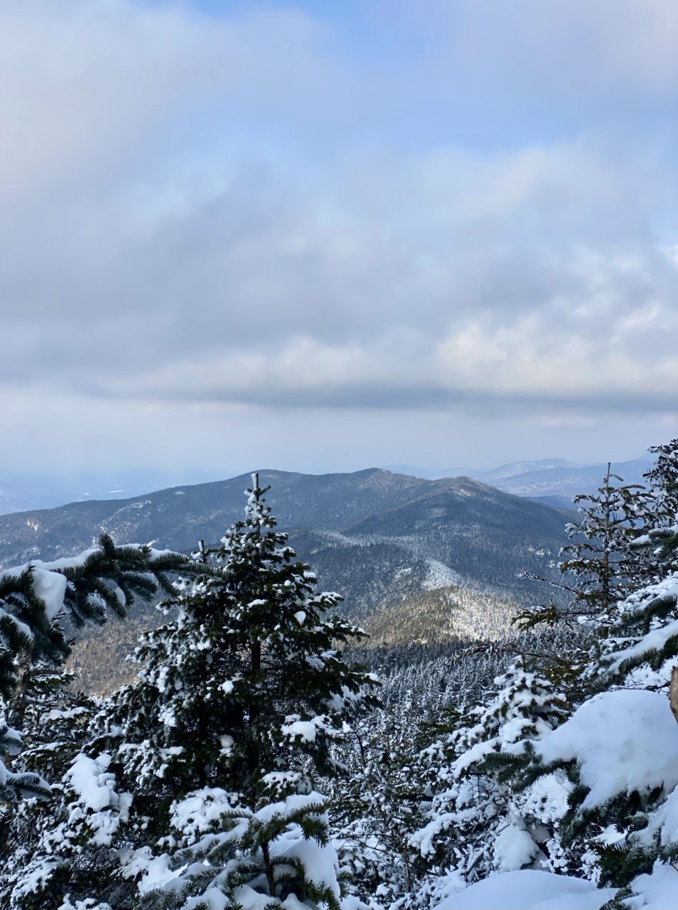
3. Mt. Abraham (4,006 ft)
I spent this winter eyeing the forecast like it was another one of my part-time jobs. With full-time teaching and marathon training on my schedule, there were only a handful of days that even allowed for a Vermont day trip. Let alone a day where the winds weren’t treacherous. Pro tip: I use Mountain Forecast to plan out my hikes. On the website, type the mountain you’re hoping to climb, and it gives you everything you need to know to make a smart decision: temperature, wind chill, wind miles per hour. All of it for the summit. I can’t tell you the number of times I went hiking when I was a beginner that I’d rely on my iPhone’s weather app and solely look up the small New Hampshire mountain town my hike started in.
I learned pretty quickly that the weather in town isn’t necessarily on the same communication channel. While it’s sunny and warm in town, it can easily be the complete opposite atop the summit.
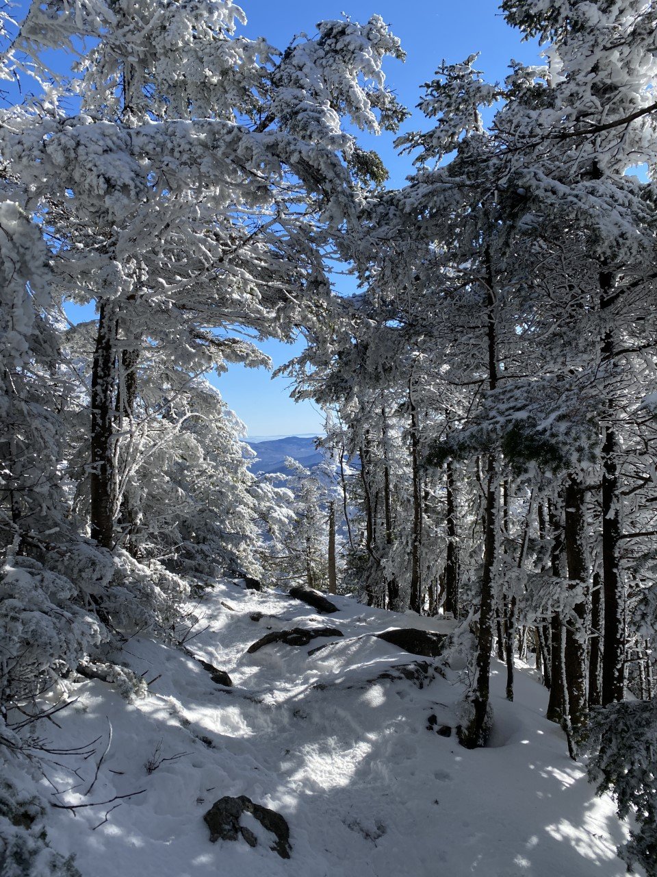
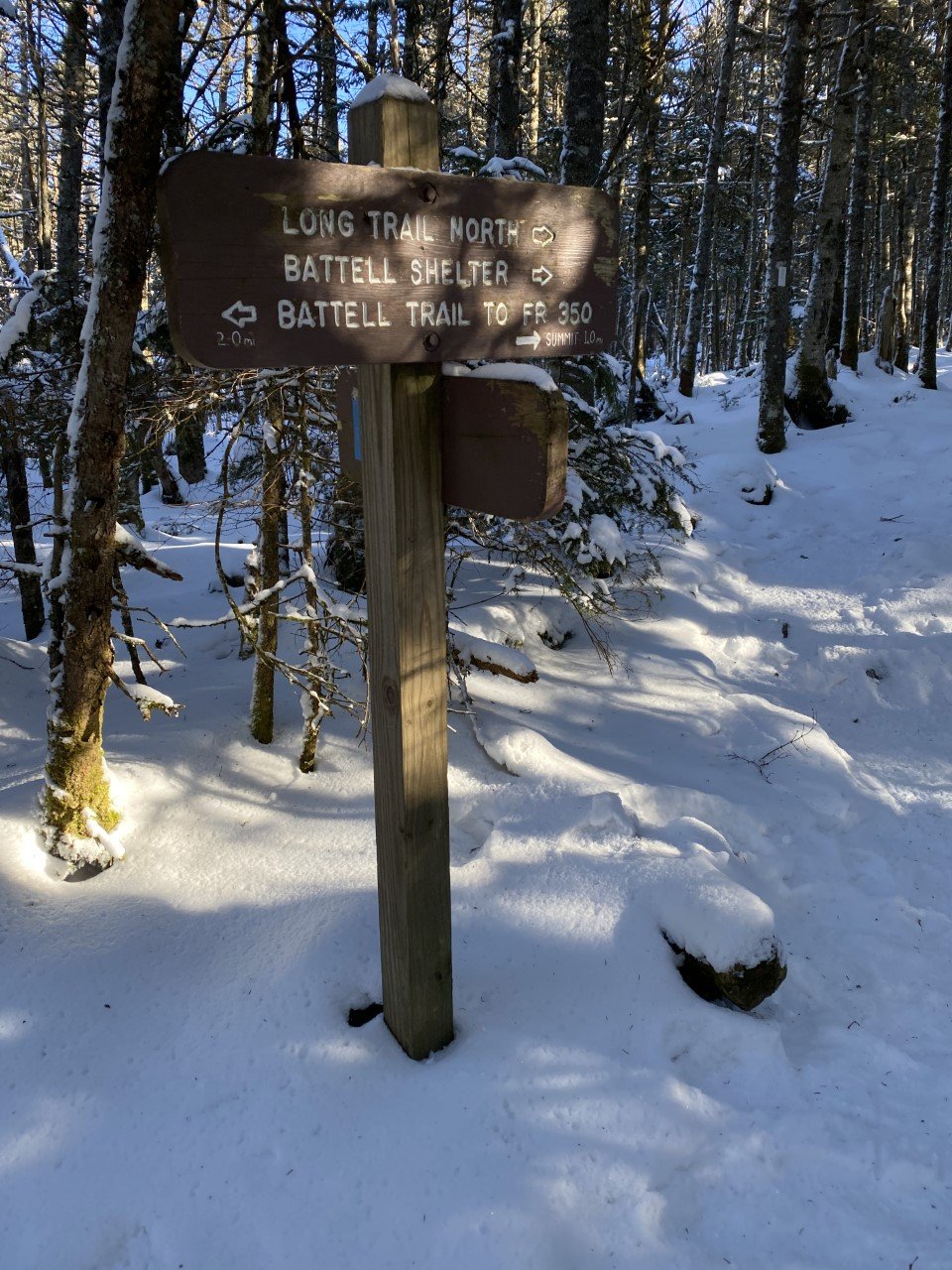
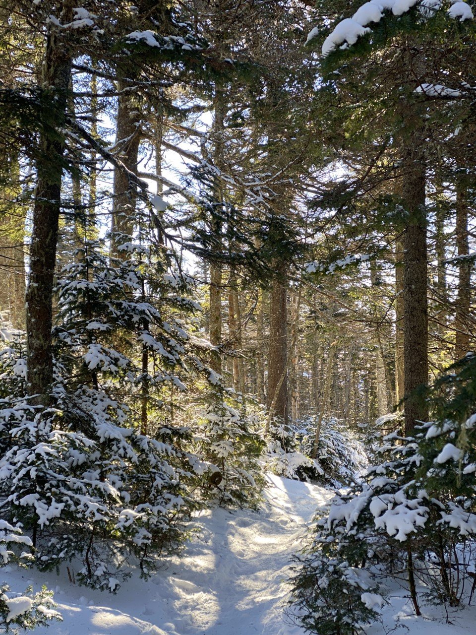
I found easy parking along Elder Hill Road, but I assume it was due to winter dissuading the average hiker from weekend adventuring. From Elder Hill Road, the Battell trail is quick to spot. Another speedy one thanks to packed down snow, I took Battell to the end when it formed into the Long Trail.
Lincoln Gap Road has a shorter distance hike to the summit, but in winter this road is closed. Regardless, Battell is roughly a six mile out-and-back. The summit offers scaping views of the Green Mountains. There is an old airplane (remnants of a crash) along the summit ridgeline, but with all the snow at the time, I didn’t come across it. Always need to leave a reason to revisit though, right?

Summit views from Abraham.
With the parking lot in sight, I logged 5.84 miles and 2,700 ft of climbing total.
4. Mt. Ellen (4,083 ft)
When I parked on Jim Dwire Road, I thought I would be the only one out on the trail today. I almost missed the trail sign because it blended in so well. There were a few cars parked on the side of the road that indicated I was indeed, in the right place. A small dirt road on a residential street, why would I find anything strange with that?
As I made my way to the tiny sliver of trail from the trail sign, I thought about the week before when I was on the opposite side of these mountains. After such a great day meeting Abraham, I could hardly wait to meet Ellen. However, Abraham didn’t relay the memo to Ellen to pack down the fresh, fluffy powder for me.
It took me quite some time to make my way to the summit as I didn’t have snowshoes. I called Ellen just about every name other than her own as I struggled to the summit. The sun was setting soon and the temperature was dropping. I made it to the summit, only to be met with skiers swiftly speeding past me.
After a moment to enjoy the view, I raced against the daylight (usually a losing battle in winter) to return to my car before the sun called it a night. At 7.11 miles roundtrip and 2,700 ft ascended, I can confidently say I met Ellen, but she wasn’t my favorite.
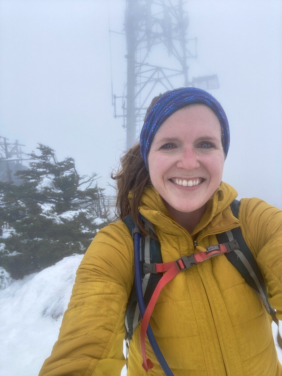
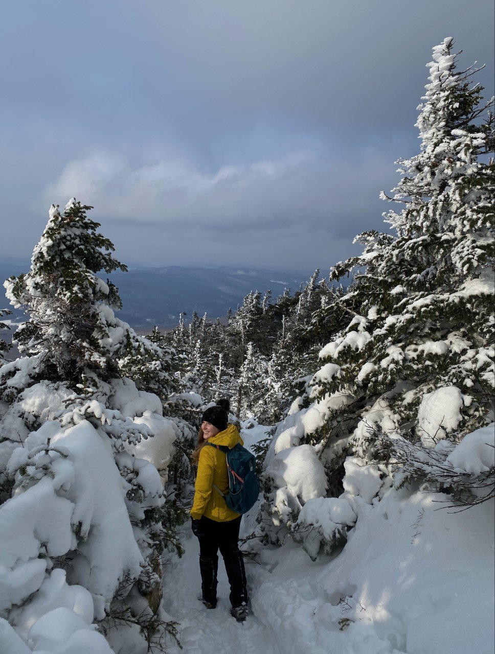
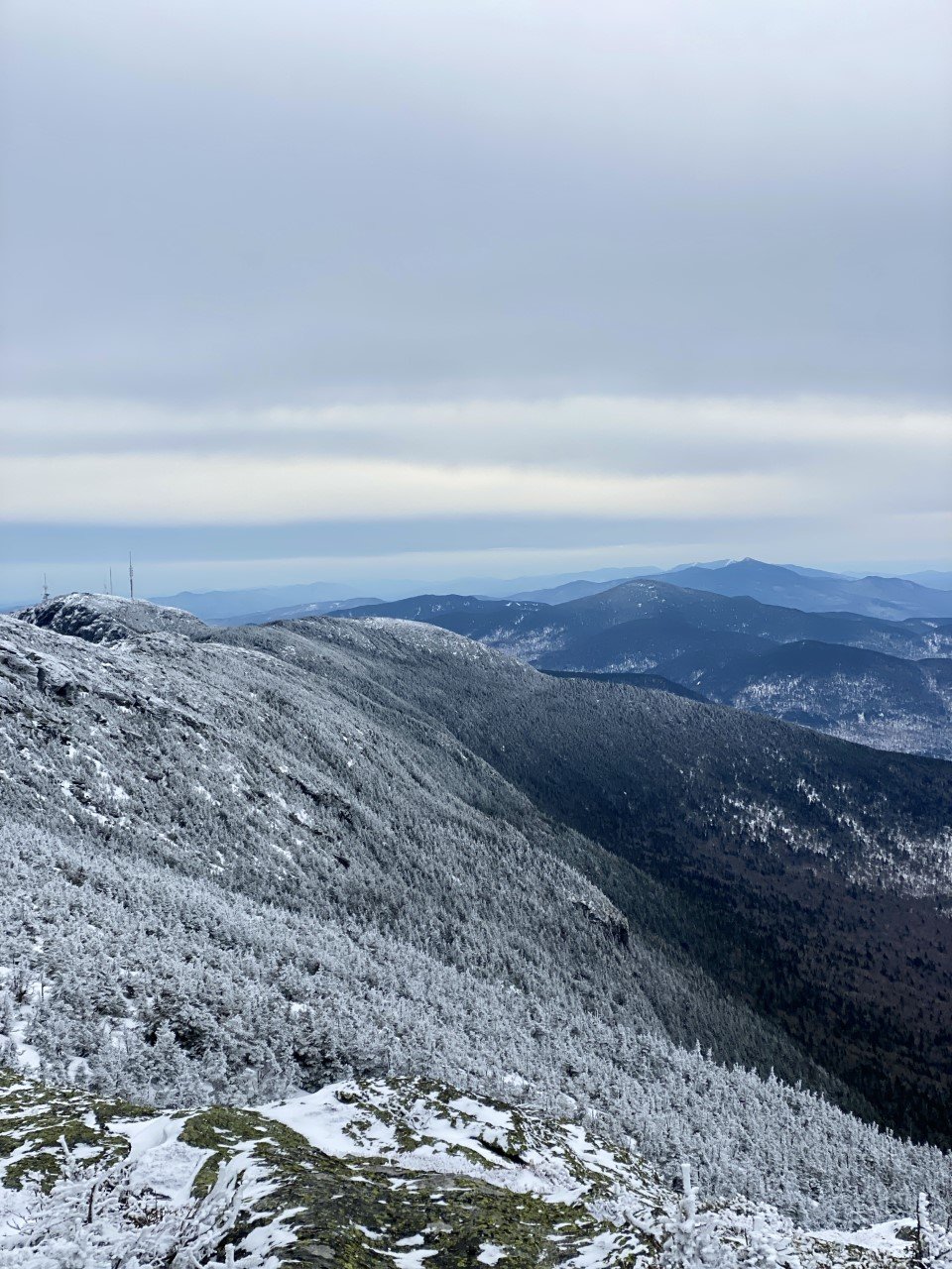
5. Mt. Mansfield (4,393 ft)

Mt. Mansfield for the big finale felt fitting. As the tallest peak in the tiny state of Vermont, I wanted a clear day at the summit. I watched the forecasts and my training plan schedule, and finally found an opening in March that let me head up Mansfield.
I parked on Mountain Road in Underhill State Park and began my steady climb along another road that isn’t maintained in winter. The road was a decent climb, but quiet. I took the CCC road with a quick shortcut thanks to the Eagles Cut trail to get me onto the trail I set out for: Sunset Ridge.
Sunset Ridge is definitely a gem of a trail. There is plenty of exposure on the trail with a little rock scrambling. Normally I love that, but with some wild winds, I was nervous about taking this trail down. Sunset Ridge joins with the Long Trail near the summit for a totally exposed view of the Green Mountains, including a nearby ski lift. I had the trail that day (and the summit) to myself, and it felt like such a great way to finish off hiking the highest peaks in Vermont.
When it came to descending, my heart sank contemplating returning Sunset Ridge with how windy and exposed it was. However out of the two trails (Sunset Ridge and Laura Cowles) from Underhill State Park, Sunset was less steep.
A seasoned hiker told me to take Laura Cowles (the steeper, tougher trail) down and I’m so glad I listened! I was originally worried of exposure descending Laura Cowles, but that trail, from the summit, quickly turns forested. Before I realized, I made my way down to the road and logged 6.6 miles and 3,130 ft of climbing.
Have you hiked any of Vermont’s highest peaks? Would you take on the VT 5?

4 Tips for Taking the Best Foliage Photos in New England
In the last five autumns I’ve spent chasing the foliage in New England and upstate New York, I’ve come up with a handful of tips through…
When I moved to New England, I didn’t know what I was getting myself into with seasons. In Texas, we’re either in summer or a chillier version of summer. What I wasn’t ready for is just how stunning fall can be. Contrastly, it can also be very difficult to decipher how to photograph such beautiful scenes.
In the last five autumns I’ve spent chasing the foliage in New England and upstate New York, I’ve come up with a handful of tips through long drives, failed hikes, and hidden gems of how to find the best photos of foliage. My pictures below are from the Adirondacks, which isn’t technically New England as it’s in New York, but given the proximity to the other mountains I frequent, the foliage timing and tips are very similar.
Here are my tips for how to take the best fall foliage photos in the Northeast:
1. If the weather is gloomy, it’s still worth making the trip.

The rain stopped when I reached the summit of Baxter Mountain and the clouds were sweeping through the layers and layers of mountains.
I used to only hike in what I considered ideal weather conditions. It had to be a sunny or clear sky, or absolutely no chance of rain. You wouldn’t catch me hiking in the rain. Wet socks, potentially wet camera gear – not my idea of a good time.
Last weekend, I was eager to get back to the Adirondacks. The only setback was a 100% chance of showers from when I arrived late Friday night to when I was leaving Sunday afternoon. I could’ve canceled. I could’ve stayed in western Massachusetts and shifted gears.
Instead, north I drove. Rainy weather has a unique way of bringing out foliage. It’s the weather of autumn and I’m embracing it this year, instead of turning away from it. Rain brings moodiness to the mountains with low moving clouds. I’m gravitating more toward this moodiness over bluebird days because you can’t plan for this scenery. It just happens because you went out and took a chance.

A cloudy day when the clouds break to let the sunlight in makes for one of my favorite views.
2. Hike lower elevations.
You don’t need to pick a 16-mile, 2,000 foot elevation gain hike to see the foliage. A drive through Lake Placid will easily give you the fall vibes! I highly recommend finding short hikes in the area you want to explore. Often times, they may not be as popular as most people are chasing a hiking list of the high peaks.
If you’re looking at the White Mountains, find a hike in the Lakes region or a less popular hike like Welch and Dickey. Shorter hikes often have parking more available as hikers head in and out at a faster pace. If you’re looking at the Adirondacks, the Lake Placid 9 (9 peaks around Lake Placid) are definitely worthwhile.

When I say hike low, I mean you don’t need to aim for 4,000 footers. Unless you want to! I decided to chase the foliage this year, and not the high peaks for autumn views.

Aerial views provided by reaching the summit of Baxter Mountain.
Don’t be fooled at these lower elevation hikes. The gain is still sweat-breaking! On some of the Lake Placid 9 hikes, you’re gaining 700-800 feet in a mile. Impressive for a 2-3 mile roundtrip hike.

Incredible views after a short hike up Mt. Van Hoevenberg.
3. Pull over when you see a worthwhile view.
There are so many incredible spots around the mountains to pull over safely and snap a photo. Think: rivers, trees, and small towns. Two weekends ago, as I was driving from Lake Placid to Wilmington, I saw a fishing spot that looked scenic.

A beautiful view of Whiteface Mountain from a parking spot at a fishing spot.
I pulled over next to a few fishermen, headed down the bank, and snapped a few shots of falls with foliage galore.

Lake Placid added a new lookout point along Mirror Lake. I stopped when I saw this view while driving by.
4. Don’t expect the perfect shot.
Most photographers edit their photos with fancy programs, so don’t go in thinking you’ll have an incredible aerial view of a mountain lake from a summit. Professional photographers are very good at their jobs – and editing is part of that!
The weather during fall is also very unpredictable. Even if the forecast calls for clouds, you may end up with constant downpour. If it calls for rain, you might get sunburnt because the sun will come out. You never know what you’re going to get – so get out there and be prepared!
Autumn is the perfect season for those moody mountain pictures. In these last couple trips, I’m more and more welcoming of clouds and rainy weather!

A rainy day led to an opening of the skies at the summit of Big Crow mountain.
Last weekend, I planned to call it quits early because of the nonstop rain. Instead, I tied my laces and headed up one of the Lake Placid 9 in Keene, New York. The rain had miraculously ceased and from the skies the clouds parted. I was enamored with foliage views for miles. And mountains immersed in the clouds. Had I just headed home early, I would’ve missed this view.
It wasn’t planned. It wasn’t the view I had seen when researching this hike. To me, it’s the perfect shot to remember the awesome feeling of a new experience hiking solo in new places.

Do you go leaf peeping? What tips would you offer someone trying to see all that foliage has to offer?

Have You Visited This Off-the-Beaten-Path Gem in Massachusetts?
When you think of outdoors adventures in Massachusetts, your mind may wander to the Cape, or hikes in the Berkshires. But have you ever heard of the…
When you think of outdoors adventures in Massachusetts, your mind may wander to the Cape, or hikes in the Berkshires. But have you ever heard of the Quabbin Reservoir?

Although the boats are intended for fishing, they also serve the purpose of pure relaxation.
I visited this reservoir my first year in Massachusetts and wasn’t too impressed. I drove about an hour northeast from Springfield, Massachusetts, to find the Quabbin Reservoir. I parked in the Visitor Center parking lot and got out of my car, eager to hike. Clearly, I didn’t do my research.
As I walked, I realized there wasn’t much hiking at the reservoir. I gazed out at the reservoir, took a few pictures, and left. It wasn’t until last weekend that I realized that the Quabbin Reservoir has way more to offer than I ever thought. And it’s an affordable adventure!
The Quabbin is actually manmade and serves as drinking water for over 3 million people. Boston friends - here’s where your water comes from!
The disheartening part of this park is that in the 1920s, Boston looked westward for a water source, and dis-established four towns in these valleys to create their water source. 2,500 residents in this part of Massachusetts lost their homes as a result.
Since millions utilize the Quabbin Reservoir as their drinking water, there are several restrictions on activity: Dogs, grilling, and swimming aren’t allowed. You might wonder what there is to do at the Quabbin then. What I didn’t know about the Quabbin Reservoir is that the Department of Conservation and Recreation (DCR) provides boat rentals (and kayaks!) for fishing. Now I’m not an avid fisherman, but after trying out my hand at flyfishing in Idaho, I thought I’d give it a try.
I headed out to the Fishing Area 1 parking. If you visit the Quabbin after 12:30 PM, boat rentals are $36 (including a $6 parking fee).

A view of the Quabbin Reservoir once you jet off in your motorboat.
You need a flotation device, but they provide one if you forget yours or don’t have one.
The beauty of the Quabbin is that it’s untouched since you can’t swim in it and there aren’t many hiking opportunities. There is a walking path around the Visitor Center, as well as two viewpoints at the Enfield Look Out and the Quabbin Tower. Otherwise, the Quabbin is really known amongst fishermen.
The motorboat fits three adults or two adults and two children. I hopped into one and set off deep into the Quabbin on a gorgeous, bluebird day. The only other boat I encountered was the DCR reminding me to return the boat an hour and a half before close.
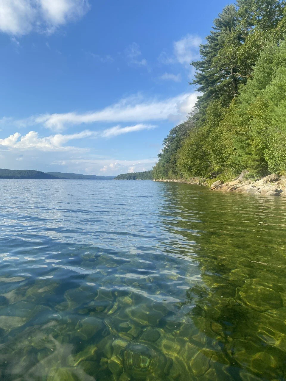
Where else will you find pristine, clear blue water like this without a soul in sight? It felt like I was back in the alpine lakes of Idaho or Montana. The best part was I was only a half hour drive from home and spent $36 for a new afternoon adventure.

Clear water and views for miles with no boat in sight.
Boats are available to rent during the Quabbin Fishing Season, which this year is from Saturday, April 17th to Saturday, October 16th. Can you just imagine the foliage colors in a couple weeks contrasting with this water? I may need to go back sooner than I planned.
Have you ever considered visiting a reservoir for a day trip? Is the Quabbin Reservoir on your list of places to visit in Massachusetts now?

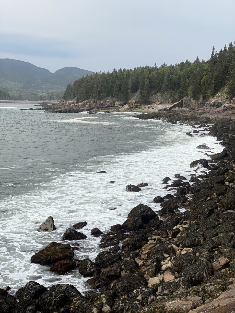
Everything You Need to See in Acadia National Park, Maine
Here’s everything you need to see and do in a weekend in Maine’s (and really, the Northeast’s) gem:
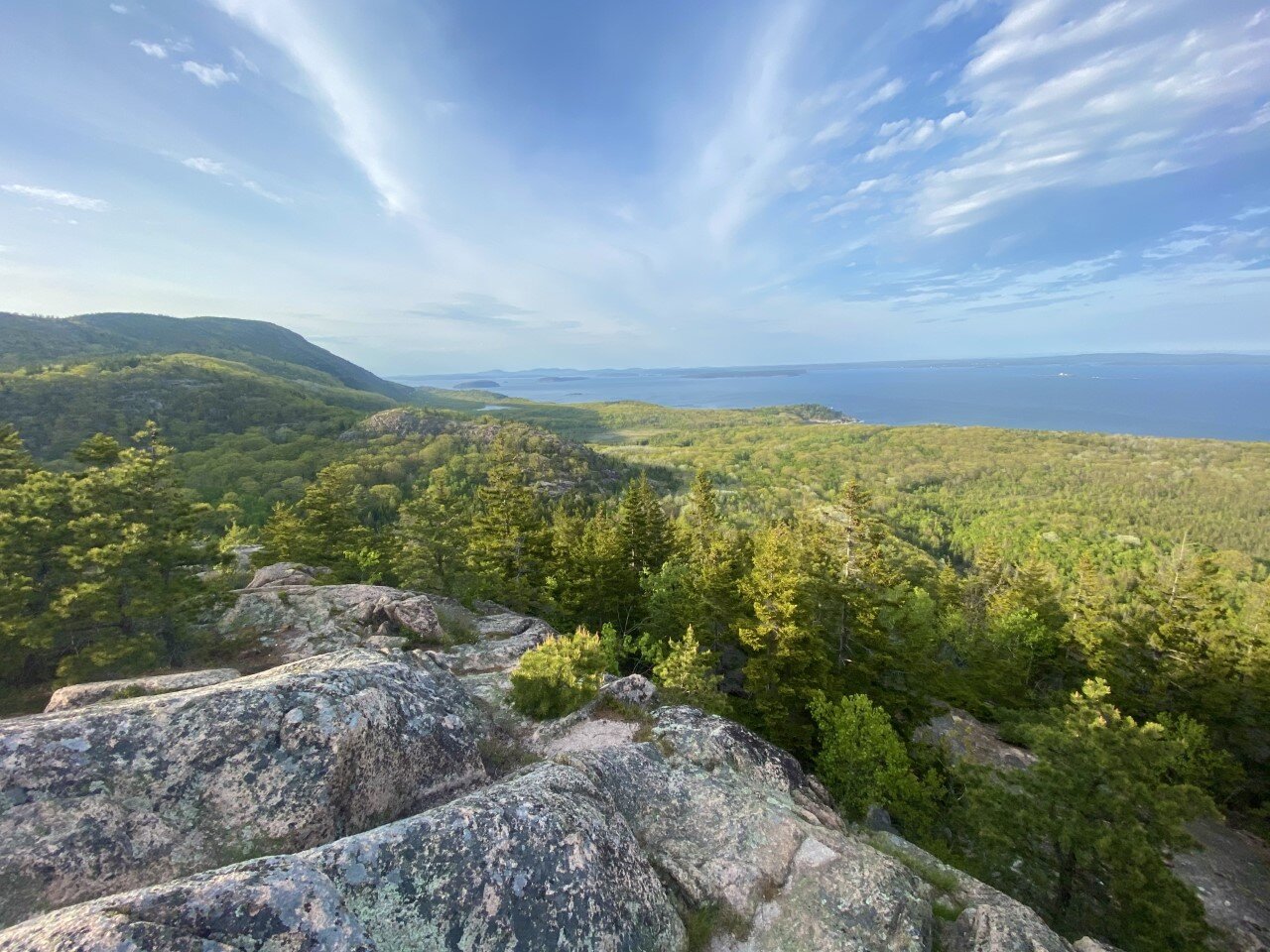
Ah, Acadia National Park — where the mountains meet the ocean. Truly, the best of both worlds.
Five years ago, I told myself I’d never run another half marathon unless it was somewhere scenic. It’s not too much to ask for to need great views when you’re running for more than two hours, right? As a result, when I came across a race in Acadia National Park, I thought to myself, this is exactly the place I would run a long race in. And so, I signed up.

I camped with a few friends on park grounds, spent the night gazing at the stars on rocks with the Atlantic breeze chilling my face. I rose the next day, ran for what felt like forever (turns out it’s a hilly course), and experienced Acadia for a brief moment.
Fast forward five years and it felt like time to revisit this spot. We stayed at a KOA (my go-to stay spot for adventures) minutes from Bar Harbor and the park. My first visit, despite running so many miles through the park, didn’t really result in me truly experiencing the park. This time around, we had an agenda full of Acadia adventures to enjoy.
New Englanders are at a slight disadvantage with the National Park system with Acadia being the only national park in the area, but a major advantage is that it’s within driving distance! For us in Western Mass, this drive is about five hours. Not rough at all considering the Adirondacks are a little over a four hour drive and I consider that a day trip sometimes.
If you find yourself looking for local adventure, or wanting to experience the beauty of coastal Maine, Acadia should move up to the top of your travel list.
Here’s everything you need to see and do in a weekend in Maine’s (and really, the Northeast’s) gem:
Hikes

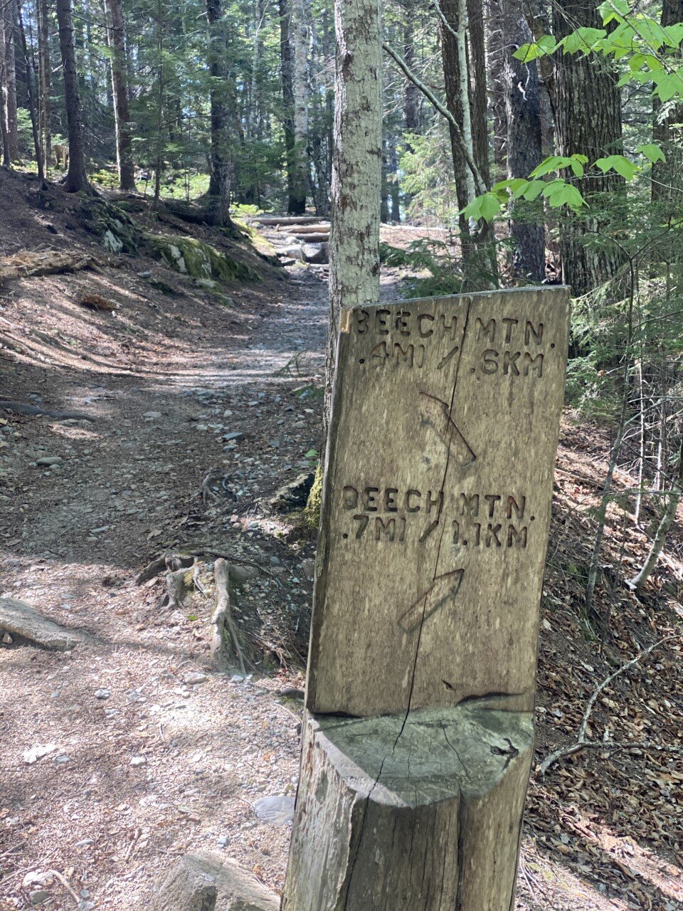
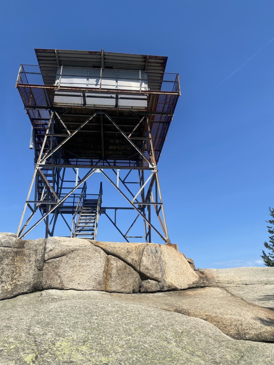
Beech Mountain
A short, somewhat rocky hike up to a fire tower with stunning views of Echo Lake and nearby peaks. The total hike is a little over a mile. I suggest hiking clockwise for the best views on this loop (along the .4 mi of the trail). You can make it about halfway up the fire tower for a better birds-eye-view. On your way down on the loop, the views get even better. I highly recommend this hike in the afternoon on a sunny day. It’s dog-friendly as well!
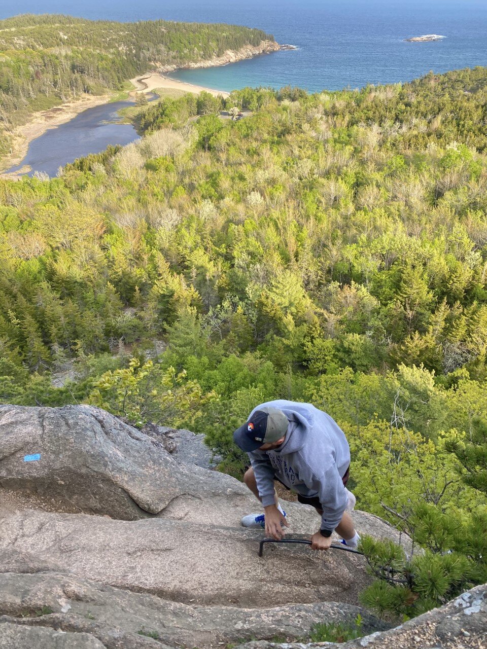
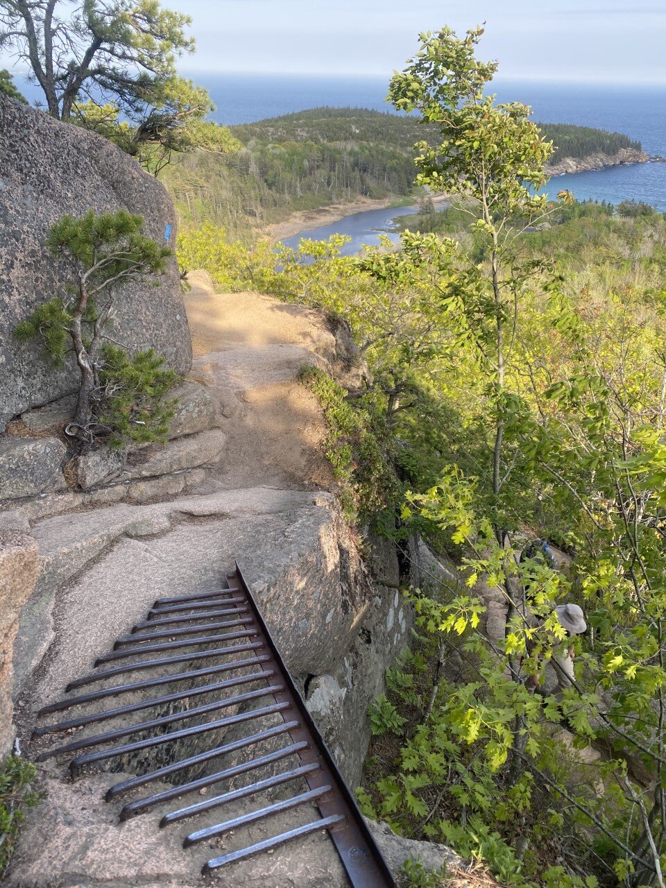
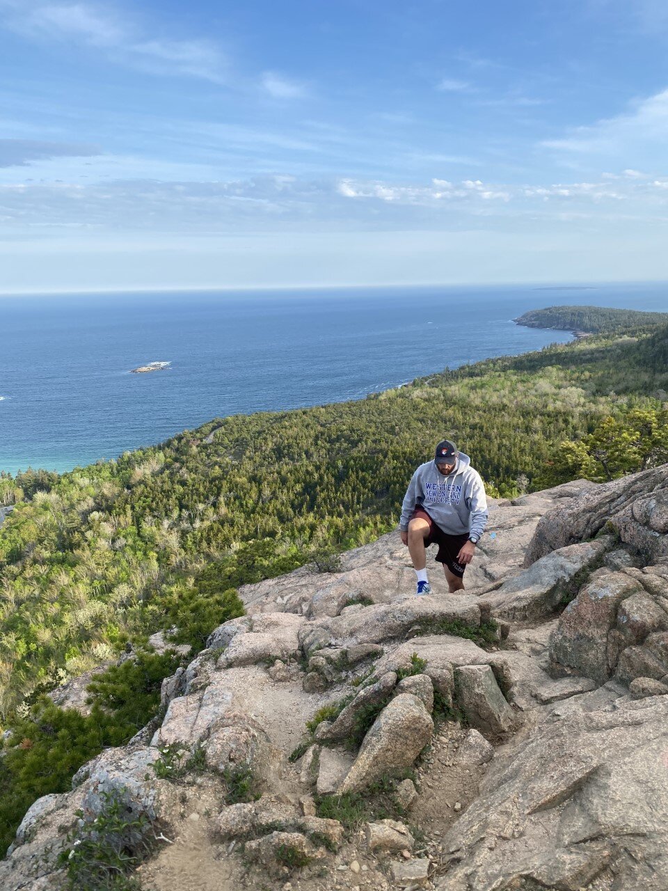
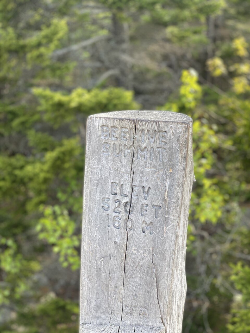
Beehive Mountain
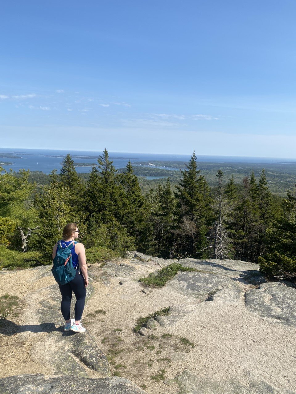
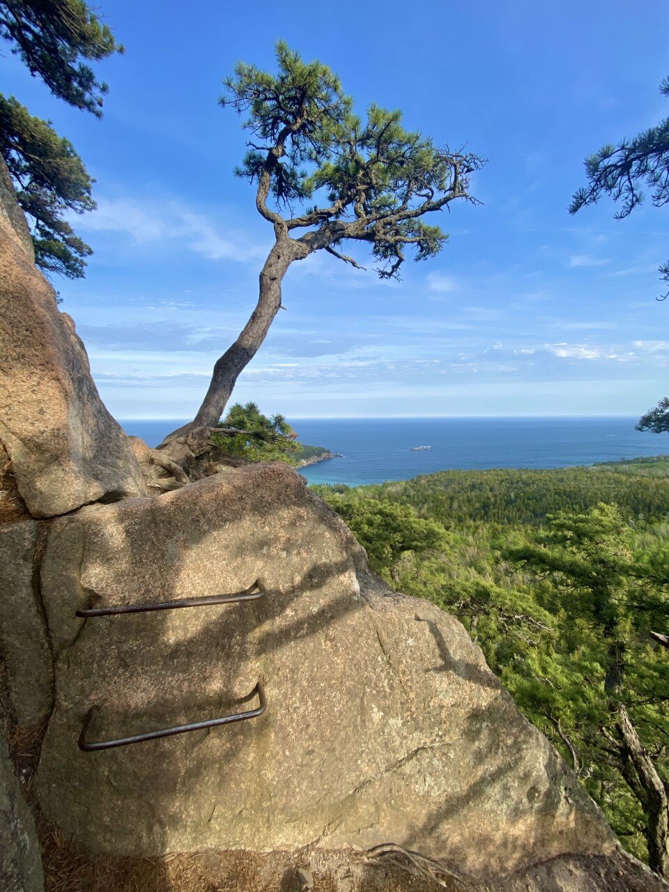
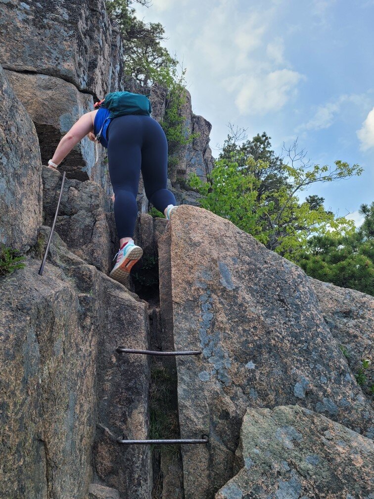
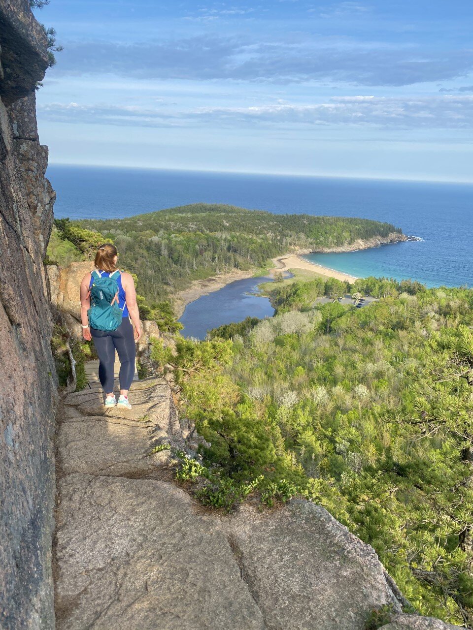
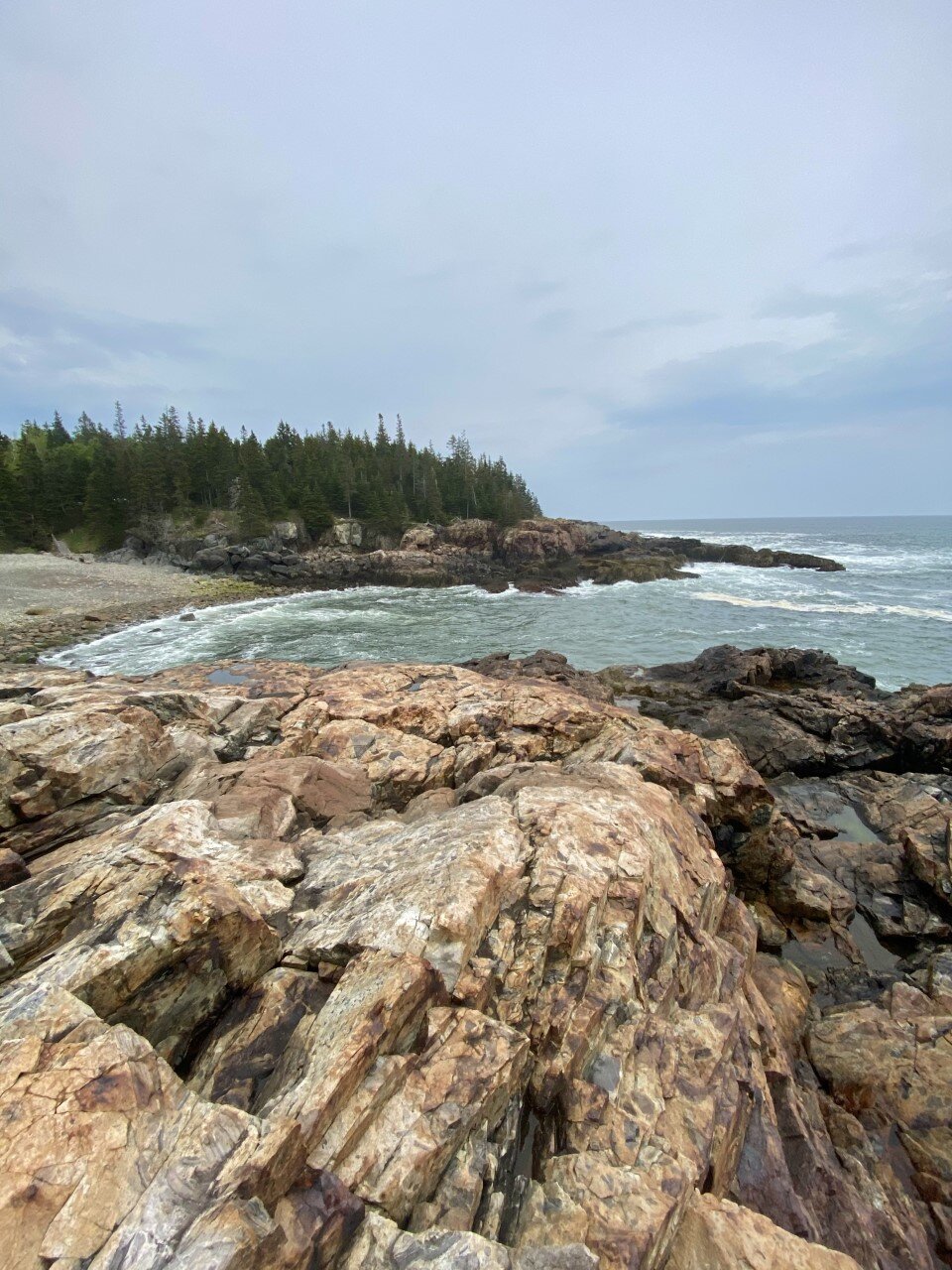
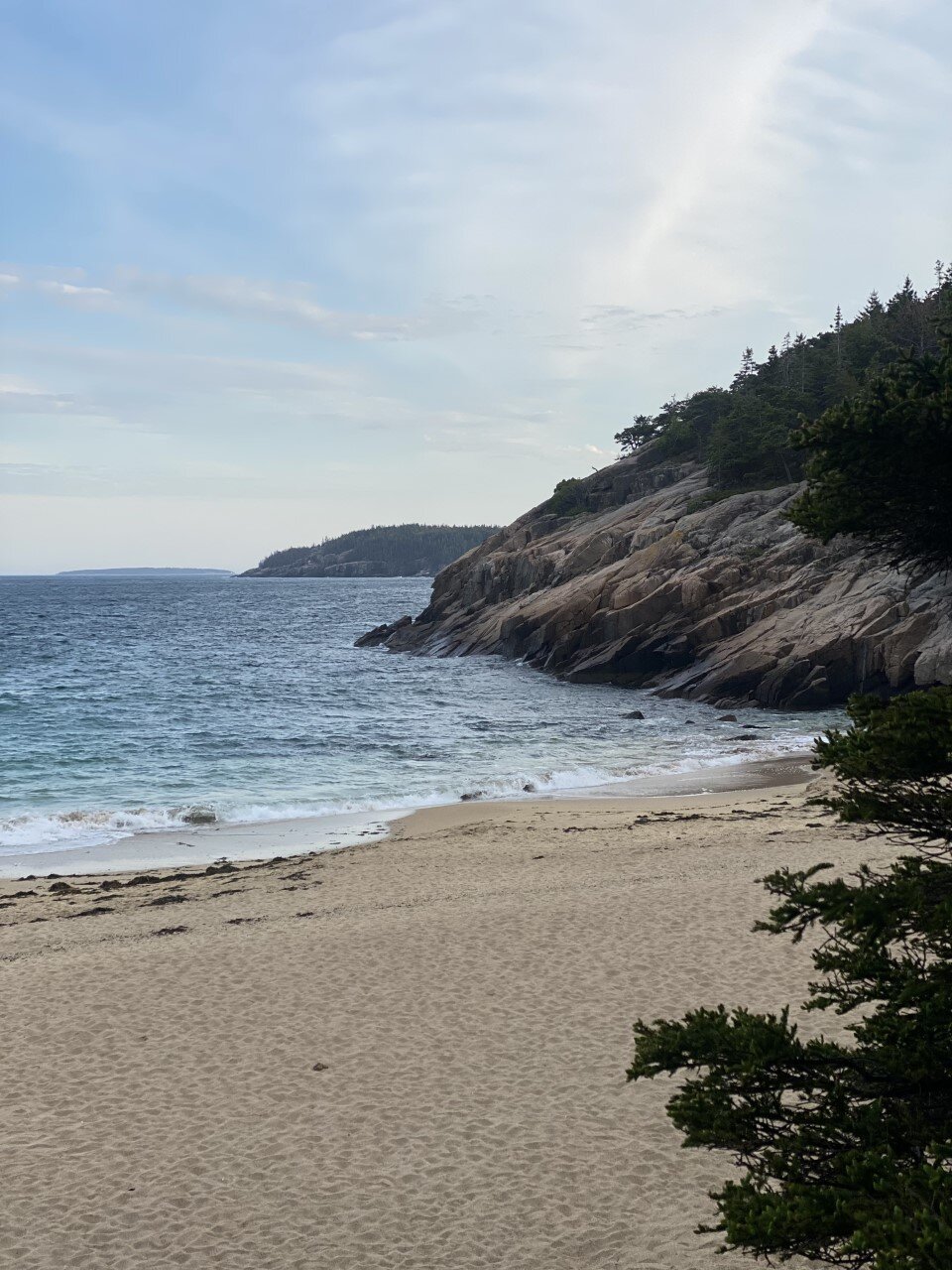
The Beehive trail has been at the top of list. I hike often, so anytime there is a little diversity in the type of terrain or trail, I jump at the opportunity to climb it. Beehive is particularly unique because of its steep incline involving rungs. I soaked it all in. One moment you’re walking along a rocky, dirt path staring up at the summit, and the next you’re climbing up rungs with your hands and gazing at the ocean and sandy beach below. Again, I’m a big fan of intriguing trails.
If you’re afraid of heights, I’d take this trail slow. It’s totally doable for all ages and completely worth it. Once you soak up the beach views, head up to the summit and immerse yourself in Norwegian-like greenery and islands. I felt like I was somewhere far away, a feeling I solemn get in New England, or the U.S. for that matter.
Precipice Trail
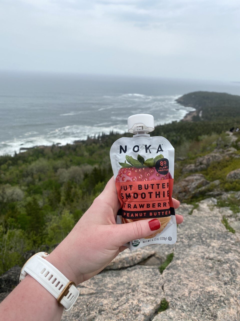
This trail sounds epic. More rungs, more incline, more steep drops - it’s my kind of adventure. You climb about 1,000 feet in under a mile. Unfortunately, both of my visits to Acadia have been in May and June, which is prime time for peregrine falcon nesting. This trail is often closed during late spring to summer for this reason. All the more reason for me to visit Acadia again one day in autumn!
Experiences:
View sunset at Bass Harbor Head Lighthouse.
Arrive an hour early to get a scenic spot on the rocks. Parking here is also limited. Bring a rain jacket as the waves enjoy crashing the rocks, thereby soaking you by default. Watch as the colors in the sky unfold before your eyes in vibrant orange and red hues.

Drive the 27-mile Park Loop road.
Stop along the way for hidden gems and solitude in spots like the ones below.

Watch the U.S.’s first sunrise at Cadillac Mountain. You need reservations for the busy summer months due to limited parking, so you’ll need to book a vehicle reservation to snag one of these coveted spots. If you’ve worked up an appetite since you woke up before 4 AM for this experience, head into Bar Harbor for breakfast at Jeannie’s Great Maine Breakfast. Always get a grilled blueberry muffin. Especially when in Maine.


Is Acadia on your list of places to explore? What are you most excited to see or do?

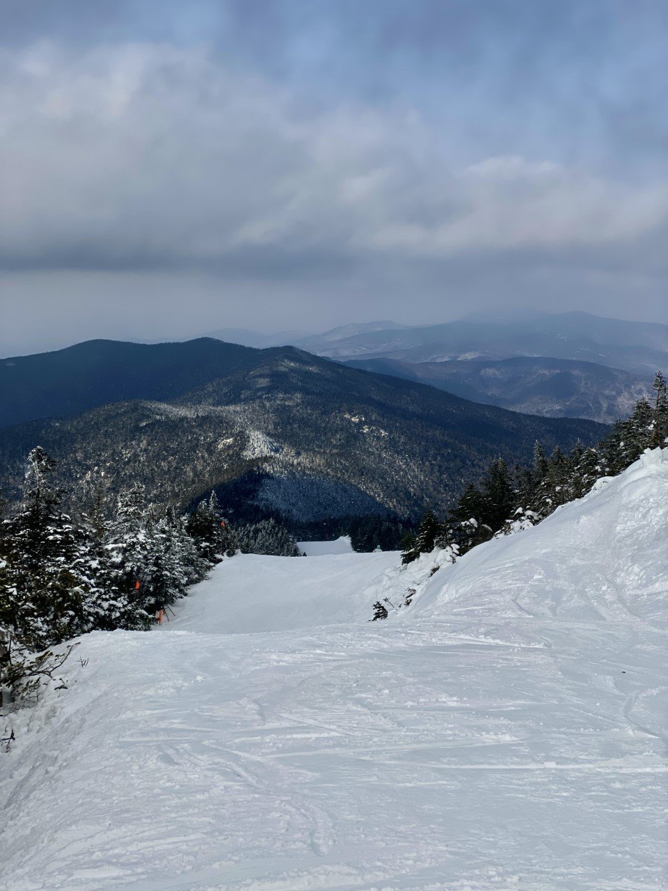
A Beginner’s Guide to Skiing
There are so many reasons not to ski. It’s expensive. It’s tough. It’s overwhelming to think about where to begin. All great reasons to try it out, right? By now you know I love the mountains and winter, so it was only a matter of time before I tried out a winter activity outside of hiking that includes my favorite things: great views, high adrenaline, and a good challenge.
I’ve only gone skiing four times in the last five years, so I’m still very much a beginner. Here’s my guide for beginner skiers (with the hope that you start skiing with paying less and enjoying more):

1. Look Local.
My first couple times skiing, I joined a friend to a popular ski destination in Vermont. The trip was essentially a hefty cost on my end to ski the bunny hill (for beginners). Heads up, there are bunny hills at every ski mountain and each time I practice on them to get what little “ski legs” I have up and moving again.
What I wish I had done is find a local ski mountain instead as I was starting out. It’s way more affordable! A nearby mountain for me cost $30 for the ski lift pass and $35 for equipment (skis, boots, and poles). It’s still a pricey way to spend an afternoon, but way better for your budget than the fancy spots.

2. Build your equipment bank.
The first time I skied, I rented (or borrowed) everything. I borrowed pants from a friend, paid $10 to rent a helmet, and wore an old winter jacket. I lucked out one snowy day that I opted out of renting goggles, but actually needed them. A ski lift operator gave me a hand-me-down pair for free. You’ll notice that skiing can get expensive, swiftly. The first time you do it, try to borrow attire from a friend and rent any remaining equipment. If you find you enjoy skiing, then begin building your equipment bank.
It takes some patience, but wait for the season to end. I purchased incredible ski pants at Eastern Mountain Sports for a fraction of the actual cost (solely because it was the end of the ski season). The following year, I purchased a helmet at Costco for $60. Each year I add to my equipment so the cost is never outrageously high for me as I continue to get into skiing.
Another tip: ski mountains and ski shops often have goodies on sale at the end of the season as well, not just adventure stores like EMS. Be on the lookout at the end of March and pre-season around September for bargain buys!
3. Know your direction. Going up the ski lift is all fun until you have to immediately hop off and are unsure of which way to go. Obviously going the wrong way can be disastrous. There are three types of trails for skiing: green circles, blue squares, and black diamonds. These are always clearly labeled on ski mountain maps and at the top of the lift.
If you’re ever uncertain, there is always an operator at the bottom of the lift before you get on that you could ask, as well as inside the lift at the top. It’s way better to clarify your direction than to end up going down a black diamond when you aren’t ready. For context, I’ve only gone down greens and I still have a great time.
Aim to do your research in advance as well. Every ski mountain has trail maps on their websites that you can download or screenshot to your phone.
4. Enjoy the learning. As someone who tried skiing in their early 20s, I was intimidated by the toddlers tackling the black diamond trails while I took on the bunny slope for the fifth consecutive time. I’m serious, it’s impressive what kids can do. They’re fearless!

Once I stopped fearing what would happen if I fell, my arms flailing reduced and I remembered the procedure for how to stop. I love that no matter what age you are, you can continue growing. Even if it means falling a time, or two.
Let me know if you’ve ever tried skiing! If you have, what tips would you give others just starting out?