Tupper Lake Triad Ultra: The Best Beginner Hiking Challenge for Dogs
I decided I wanted to complete Tupper Lake Triad in a day with my dog— three hikes totaling 7.4 miles and 1,975 feet of climbing. Here’s everything you need to know for a Tupper Lake Triad Ultra:
Lake views from the fire tower atop Mt. Arab on an October morning.
After finishing the Northeast 115, I wasn’t drawn to any particular hiking challenge. Once leaves began to change, so did my feelings toward a new goal. I set my sights on a trio of trails that I could do with my favorite hiking partner, Poppy. Poppy spent the summer hitting the trails with me and seemed ready for a bigger day.
Despite her love for the trails, she hasn’t hiked any 4,000-footers. Yet. She earned her trail legs last month in October when we headed up to Tupper Lake in New York to take on the Tupper Lake Triad—a list of three summits in the scenic town of Tupper Lake comprised of: Mt. Arab, Goodman Mountain, and Coney Mountain. A trip to Tupper Lake could include one of these alone and it would be a wonderful time spent outside. However, I wanted to tackle all three in a day to complete the Tupper Lake Triad Ultra – something Poppy and I could do together. In a day, these three hikes total 7.4 miles and 1,975 feet of climbing. If you subtract the short drives in-between, it almost feels like a 4,000 footer. Great practice for my trail buddy!
Everything you need to know for a Tupper Lake Triad Ultra:
1. Mt. Arab (2,525 feet)
Location: Mt Arab Rd, Tupper Lake, NY 12986 (Mt. Arab Trailhead & Parking)
Distance and elevation: 2.1 miles out-and-back, 768 ft gain
Parking: Plenty of parking with multiple spots opening up both when we arrived and when we left at the Mount Arab Trailhead Parking.
Trail: Take the Mount Arab trail up to the summit, and back down.
Mt. Arab was my favorite of the three mountains mostly because I’m a sucker for a fire tower. I love seeing expansive views, and it’s almost a guarantee when it comes to an Adirondack fire tower (weather permitting, of course).
2. Goodman Mountain (2,190 feet)
Location: Adirondack Park Preserve, Tupper Lake, NY 12986 (Goodman Mountain Trailhead)
Distance and elevation: 3.1 miles out-and-back, 607 ft gain
Parking: Plenty of parking at the Goodman Mountain Trailhead, and with the hike being so short, multiple spots opened up in the time we arrived and departed.
Trail: Take the Goodman Mountain trail up to the summit, and back down.
Excellent views from the summit of Goodman Mountain.
3. Coney Mountain (2,264 feet)
Location: NY-30, Tupper Lake, NY 12986 (Coney Mountain Trailhead)
Distance and elevation: 2.2 miles out-and-back, 600 ft gain
Parking: There are only one or two spots at the Coney Mountain parking area. Parking is available on the very busy road, but the spots are endless.
Trail: Take the Coney Mountain trail up to the summit, and back down.
Receiving your Completion Patch
Once you complete all three (in a day or over multiple days), submit your registration to the Regional Office of Sustainable Tourism with $5 for a patch for you and your pup. The Tupper Lake Triad challenge offers online registration. My patch arrived in my mailbox within a week!
Preparing Your Pup
I trained Poppy on local trails prior to tackling the high elevation gain of all three hikes in one day. A big advantage of the Tupper Lake Triad is that although the elevation gain mirrors an Adirondack 46er, the trails are very well-maintained and accessible. Driving from trailhead to trailhead gave her a chance to recover before the next hike.
Affordable Lodging Near Tupper Lake, NY
Since Tupper Lake is roughly a four-hour drive away from home, I opted to camp at a nearby state campground—Fish Creek Pond. This campground has plenty of sites, bathrooms, and views.
I wanted to test out an air mattress in the back of my SUV, so we car camped at Fish Creek. Definitely worth it!
Where to Eat in Tupper Lake, NY
In this area of the Adirondacks, I always gravitate to Raquette River Brewing. They truly have it all: a plethora of food trucks, beers, and parking spots.
Is the Tupper Lake Triad (ultra or not) making it onto your hiking list? If you enjoyed learning about this hiking challenge then you’ll love exploring these:
Hike the Vermont 5 4,000 Footers
Lake Placid 9er Hiking Challenge
Twins Zealand Bonds Traverse (part of the NH 48 Challenge)
Hiking Esther Mountain in the Adirondacks
On my hike up Whiteface, we took a slight detour in the wrong direction. When we approached the trail sign for Esther, and read, “path not maintained or marked,” we trudged on to Whiteface. After all, I wasn’t chasing the 46er list.
Joke’s on me because three years later…
I first discovered the Adirondacks from one of my best friends in college who was living in Hawaii at the time. She sent me a picture of Whiteface’s stony summit path and said, “you have to go there.” Naturally, I drove four hours the next morning (luckily it was the weekend), drove the road up Whiteface, and indulged in the best foliage I had ever seen. Still possibly the best foliage in all my years living in New England since.
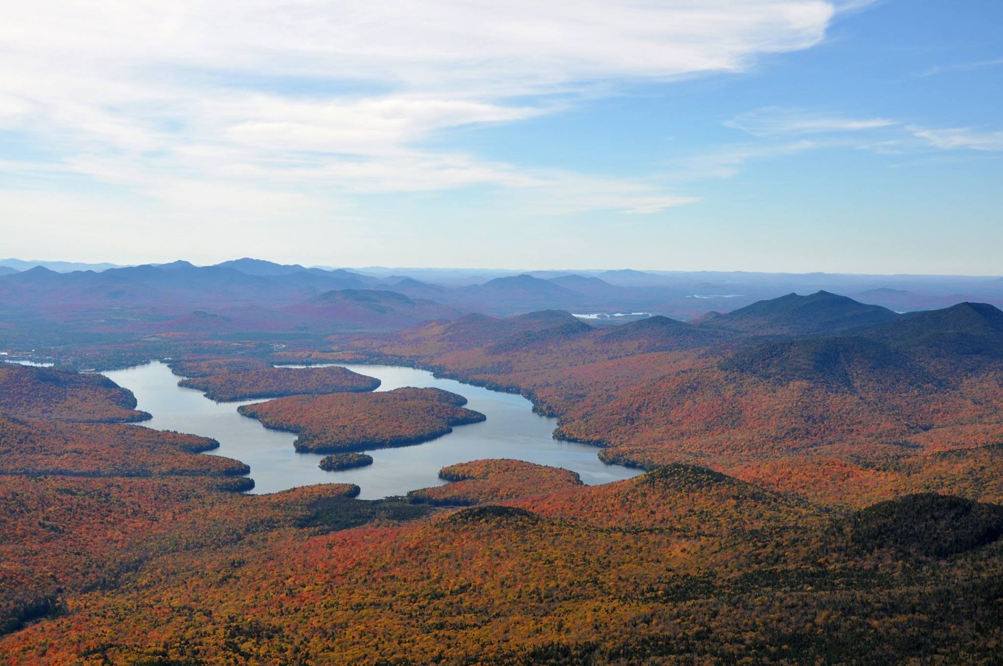
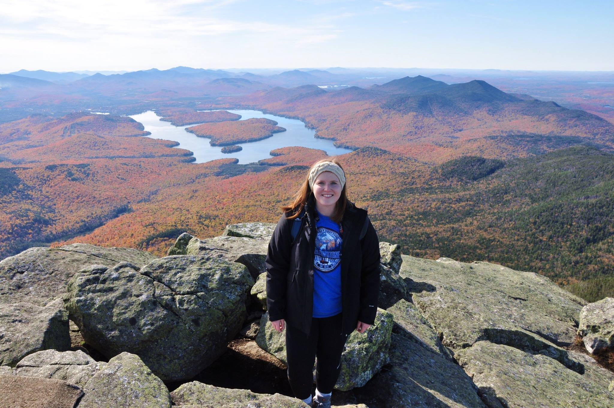
I mean look at those colors. I took the photos of Whiteface Mountain below back in October 2016. I had only survived the Franconia Ridge the summer prior and had no idea the mountains and views in store when I’d move to Massachusetts the following year.
Little did I know that five years later I’d hike up the very mountain that first introduced me to the Adirondacks.
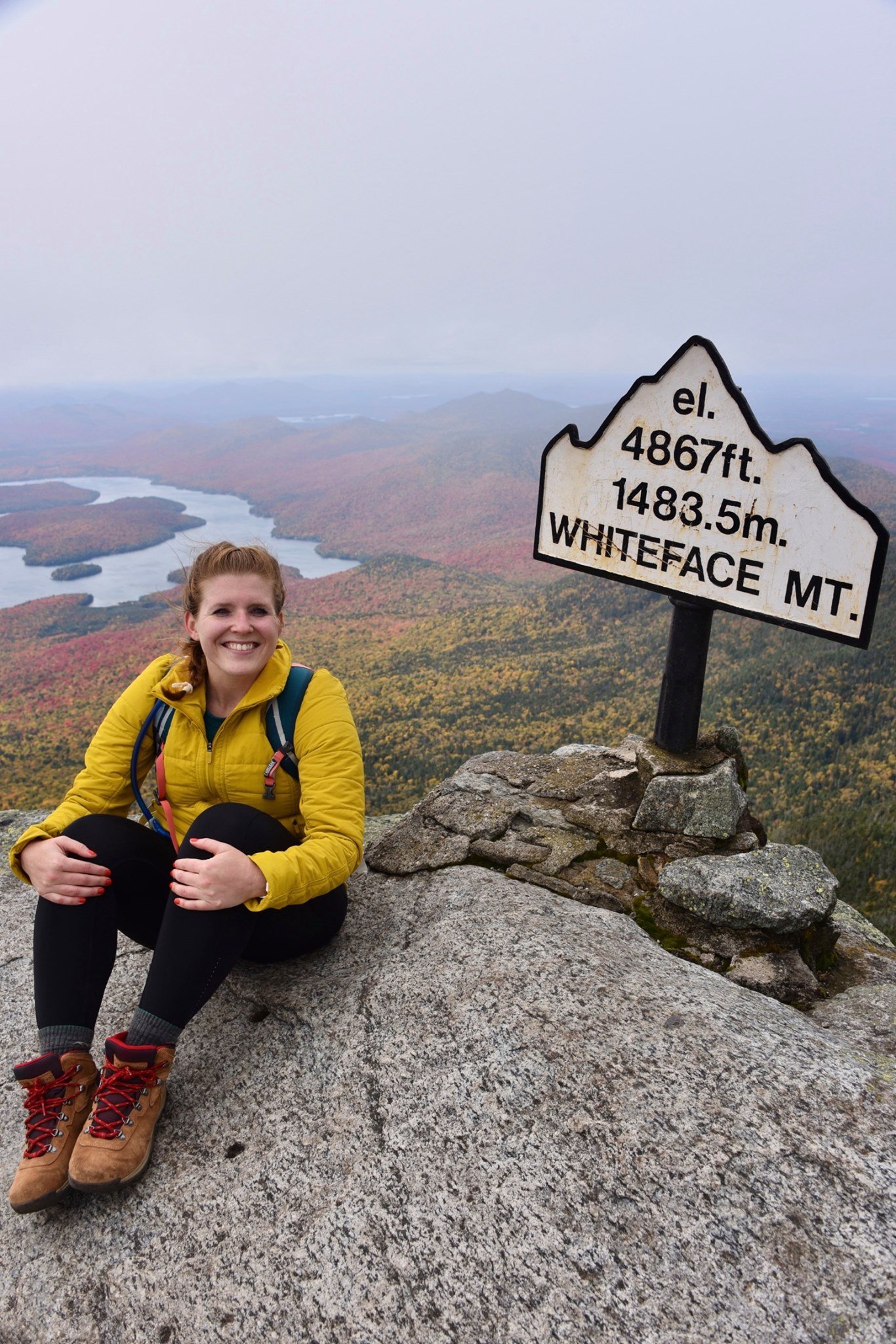
Whiteface Mountain in October 2020
Featuring a naive me, thinking I wouldn’t take on the Adirondack 46 at some point.
It also comes in at 4,867 feet, making it one of the highest peaks in the Adirondacks. Of course this places Whiteface on the 46er list (New York’s 46 highest peaks). Along one trail to Whiteface is a short detour to Esther Mountain.
On my hike up Whiteface, we took a slight detour in the wrong direction. When we approached the trail sign for Esther, it read, “path not maintained or marked.” Dejected from the detour, we trudged onward to Whiteface. After all, I wasn’t chasing the 46er list. I was there to spend time outside, and see the foliage. Not push on to a viewless summit in uncharted terrain.
Joke’s on me because three years after my Whiteface ascent, I decided I wanted to tackle the 46 highest peaks in the Adirondacks. So here I was with a free Saturday and a craving for a good climb. The weather was sunny and the temperature was moderate. I made a go for it!
Last weekend, I parked at the Atmospheric Sciences Research Center at 110 Marble Mt Ln, Wilmington, NY 12997. Plenty of parking here, but be sure to not park at the center itself. The trail is indicated with a visible sign.
From the start of the trail, it’s a lovely (short-lived) flat path before the 2,000 foot climb begins. A real-world, snow-covered stair climber. What more could you wish for?
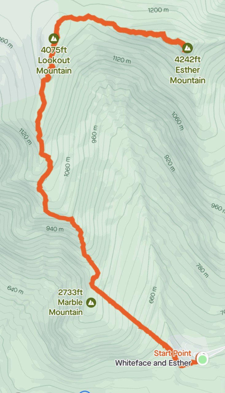
Trail Route from Strava
An out-and-back 6.3 miles with about 2,800 feet of elevation gain.
The great part in summer is that the sunshine is covered for this brutal, sweaty climb. The best part in winter when all the tree branches are bare, is that the sun shines just enough to warm your uncovered face, while the rest of your body is fired up.
I love a good climb, and Esther was no different. At about .8 miles, you reach Marble Mountain, roughly 2,700 feet. A great break spot, complete with rocks to sit on and a view worth gazing at. When you’re done, the next leg of the trip continues to climb (shocking, I know), up to Lookout Mountain at 4,075 feet.
Snowshoes are actually required in the Adirondacks during the winter with more than 8 inches of snow.
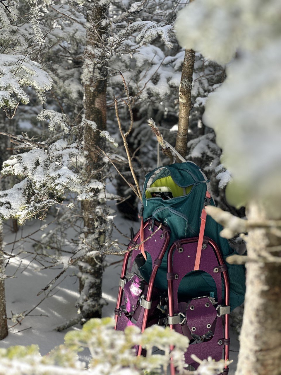
The trail was very packed down, so I used microspikes on the ascent. I thought I’d try out my new snowshoes on the descent and they were incredible. These Winter Walker snowshoes from L.L.Bean are super affordable and did me well on a 4,000 footer! They are currently on sale too!
Esther Trail
The iconic Esther sign I referenced earlier is at this point, where you can either turn left for Whiteface, or head right, to the “not maintained” path. The beauty of winter (and several snowshoers before you) is having a very clear path outlined for you. I never faltered from the trail.
After a bit more climbing (several hundred feet), I soaked up the summit to myself. Everyone I have talked to Esther about always brings up the summer mudfest, or the lack of summit views. I’m not sure if it was because this was my first hike back in the Adirondacks after months away with marathon training, or if there were several feet of snow that elevated me, but I loved the far-off views of Whiteface I saw.
I’m a little biased because I also love winter hiking. A lot. I spent about an hour on the summit wanting to enjoy the perfect day before I headed down.
When I reached my car, I clocked in about 2,800 feet of climbing in 6.3 miles of going out-and-back on the Marble Mountain trail to the Esther trail.
The mountain is apparently named after Esther, a fifteen-year-old girl who was the first known person to summit. Turns out, she hiked up here just for the love of hiking. How fitting considering that was the exact way I felt all day up there. Hiking up Esther Mountain in the winter is definitely the way to go.
This was my 21st peak of the 46. Here’s to many more summit smiles!
If you enjoyed this trail review, check out these mountains:
Cascade and Porter Mountains in the ADKs
Twins, Zealand, Bonds Traverse in the Whites
4 Tips for Taking the Best Foliage Photos in New England
In the last five autumns I’ve spent chasing the foliage in New England and upstate New York, I’ve come up with a handful of tips through…
When I moved to New England, I didn’t know what I was getting myself into with seasons. In Texas, we’re either in summer or a chillier version of summer. What I wasn’t ready for is just how stunning fall can be. Contrastly, it can also be very difficult to decipher how to photograph such beautiful scenes.
In the last five autumns I’ve spent chasing the foliage in New England and upstate New York, I’ve come up with a handful of tips through long drives, failed hikes, and hidden gems of how to find the best photos of foliage. My pictures below are from the Adirondacks, which isn’t technically New England as it’s in New York, but given the proximity to the other mountains I frequent, the foliage timing and tips are very similar.
Here are my tips for how to take the best fall foliage photos in the Northeast:
1. If the weather is gloomy, it’s still worth making the trip.
The rain stopped when I reached the summit of Baxter Mountain and the clouds were sweeping through the layers and layers of mountains.
I used to only hike in what I considered ideal weather conditions. It had to be a sunny or clear sky, or absolutely no chance of rain. You wouldn’t catch me hiking in the rain. Wet socks, potentially wet camera gear – not my idea of a good time.
Last weekend, I was eager to get back to the Adirondacks. The only setback was a 100% chance of showers from when I arrived late Friday night to when I was leaving Sunday afternoon. I could’ve canceled. I could’ve stayed in western Massachusetts and shifted gears.
Instead, north I drove. Rainy weather has a unique way of bringing out foliage. It’s the weather of autumn and I’m embracing it this year, instead of turning away from it. Rain brings moodiness to the mountains with low moving clouds. I’m gravitating more toward this moodiness over bluebird days because you can’t plan for this scenery. It just happens because you went out and took a chance.
A cloudy day when the clouds break to let the sunlight in makes for one of my favorite views.
2. Hike lower elevations.
You don’t need to pick a 16-mile, 2,000 foot elevation gain hike to see the foliage. A drive through Lake Placid will easily give you the fall vibes! I highly recommend finding short hikes in the area you want to explore. Often times, they may not be as popular as most people are chasing a hiking list of the high peaks.
If you’re looking at the White Mountains, find a hike in the Lakes region or a less popular hike like Welch and Dickey. Shorter hikes often have parking more available as hikers head in and out at a faster pace. If you’re looking at the Adirondacks, the Lake Placid 9 (9 peaks around Lake Placid) are definitely worthwhile.
When I say hike low, I mean you don’t need to aim for 4,000 footers. Unless you want to! I decided to chase the foliage this year, and not the high peaks for autumn views.
Aerial views provided by reaching the summit of Baxter Mountain.
Don’t be fooled at these lower elevation hikes. The gain is still sweat-breaking! On some of the Lake Placid 9 hikes, you’re gaining 700-800 feet in a mile. Impressive for a 2-3 mile roundtrip hike.
Incredible views after a short hike up Mt. Van Hoevenberg.
3. Pull over when you see a worthwhile view.
There are so many incredible spots around the mountains to pull over safely and snap a photo. Think: rivers, trees, and small towns. Two weekends ago, as I was driving from Lake Placid to Wilmington, I saw a fishing spot that looked scenic.
A beautiful view of Whiteface Mountain from a parking spot at a fishing spot.
I pulled over next to a few fishermen, headed down the bank, and snapped a few shots of falls with foliage galore.
Lake Placid added a new lookout point along Mirror Lake. I stopped when I saw this view while driving by.
4. Don’t expect the perfect shot.
Most photographers edit their photos with fancy programs, so don’t go in thinking you’ll have an incredible aerial view of a mountain lake from a summit. Professional photographers are very good at their jobs – and editing is part of that!
The weather during fall is also very unpredictable. Even if the forecast calls for clouds, you may end up with constant downpour. If it calls for rain, you might get sunburnt because the sun will come out. You never know what you’re going to get – so get out there and be prepared!
Autumn is the perfect season for those moody mountain pictures. In these last couple trips, I’m more and more welcoming of clouds and rainy weather!
A rainy day led to an opening of the skies at the summit of Big Crow mountain.
Last weekend, I planned to call it quits early because of the nonstop rain. Instead, I tied my laces and headed up one of the Lake Placid 9 in Keene, New York. The rain had miraculously ceased and from the skies the clouds parted. I was enamored with foliage views for miles. And mountains immersed in the clouds. Had I just headed home early, I would’ve missed this view.
It wasn’t planned. It wasn’t the view I had seen when researching this hike. To me, it’s the perfect shot to remember the awesome feeling of a new experience hiking solo in new places.
Do you go leaf peeping? What tips would you offer someone trying to see all that foliage has to offer?
Hiking Cascade and Porter Mountains in the Adirondacks
Winter in the mountains is surreal. Growing up in Texas meant only seeing snow once or twice, and it was mostly ice. I am absolutely enamored by the winterscape in the northeast. From snow-capped peaks to the crunch of spikes in snow on the trail, to the summit sunsets that are more frequent with shorter daylight times. Selfishly I also enjoy having trails to ourselves and not heavy crowds.
This past week, we ventured up to the Adirondacks, a magical gem in New York that feels like New York’s best kept secret. It’s a long drive for many, and it’s not a national park, so it’s not extremely well-known. However, for hikers in New England, it’s a popular destination. Like the New Hampshire 48, there’s a list of 46 high peaks in the Adirondacks that results in accomplishment (and a patch, of course) if completed.
I’ve hiked a couple, but never in winter. Winter in the Adirondacks feels otherworldly to me because of my few trips up there. My first trip up was five years ago. One of my best friends who lived in Hawaii at the time sent me a picture of the Adirondacks and told me I should go. I made a day trip that weekend, which became the first of an annual fall foliage trip.
This trip, however, would be the first attempt of a winter trek in these vast mountains. We set our hearts on two of the 46: Cascade and Porter. After arriving in the early afternoon to a nearly empty parking lot, we set out on the 2.4 mile ascent to Cascade along the Cascade Mountain trail. The trail was packed down and clearly labeled. Right before the summit of Cascade, at about 2 miles, there is a y on the trail. One direction leading up to Cascade (head toward “privy”), and the other about .6 miles to Porter. We headed up Cascade first.
One of my favorite parts of winter hiking is the lowered probability of getting lost because you only have two options: follow the trail another hiker sweetly packed down for you, or dive into feet of untouched snow. Seems obvious.
The wind was brutal at the summit, so we descended almost as quickly as we made it above treeline. Beautiful bluebird days can be deceiving weather-wise since we were met with 20 mph winds producing a negative windchill experience atop Cascade.
Afterwards, Porter was a fast and beautiful jaunt with views of Cascade. I love ridgelines because you get to see how far your hike has taken you.
Cascade Mountain trail to the summit of Cascade Mountain (view from Porter Mountain).
We headed down Porter the way we came up and the rest of the hike was a swift and smooth descent. It was also our dog Koah’s first two of the 46! After this trip, I’m already starting to plan the next. The 46 just might be the next hiking challenge we take on.
Should the ADK 46 be our next list to take on? Have you hiked any of the 46 high peaks?


