
3 Colorado National Parks to Visit That Aren’t Rocky Mountain
Great Sand Dunes • Black Canyon of the Gunnison • Mesa Verde

This is in Colorado. I know, I was shocked too.
When you think of Colorado, what comes to mind? Almost immediately glimpses of Denver appear or the snow-capped summits of the Rocky Mountains range wander through your head. Denver and the Rockies definitely deserve the hype, but they aren’t all that Colorado has to offer you!
Next time you plan a trip out West, or one to Colorado specifically, add these lesser-known destinations to your must-see list. My biggest piece of advice is to purchase the Annual Parks Pass ($80). If you do a Southern Colorado trek, each of these parks have entrance fees of $15-$30, so it may be more beneficial to pay the one-time $80 cost. I’m all about saving money where I can! I happened to also be trekking to Moab, Utah, so I knew I’d save since I was also entering three parks there that each have an entrance fee.
Last summer on a cross-country road trip, the ultimate destination was Idaho. How to get there, however, was up for discussion. After some great Kansas City barbeque, Colorado seemed like it was just minutes away, so I planned for that state next on the itinerary.

Colorado is home to four national parks— one of which is way more popular than the others. Rocky Mountain National Park is well-known for good reason! It’s easily accessible from Denver and it’s breathtaking. I visited the park a few years ago, so I opted out of revisiting this time around.
Instead, I traversed southern Colorado exploring the other national parks this gorgeous state has to offer. And what I discovered is that they are each true gems that not many people know about!
While you need a permit now to enter Rocky Mountain National Park due to its extreme popularity and congestion (4.4 million visitors in 2021!), the remaining three national parks have so few visitors it’ll feel like you have the park to yourself at some times.
Though I love a good tourist moment like when you first lay eyes on the Rockies, or when you witness the exact point when Ol’ Faithful erupts, I also take great pleasure in those quieter moments. The ones that not many are able to experience.
Here are the national parks that you should definitely visit in Colorado:
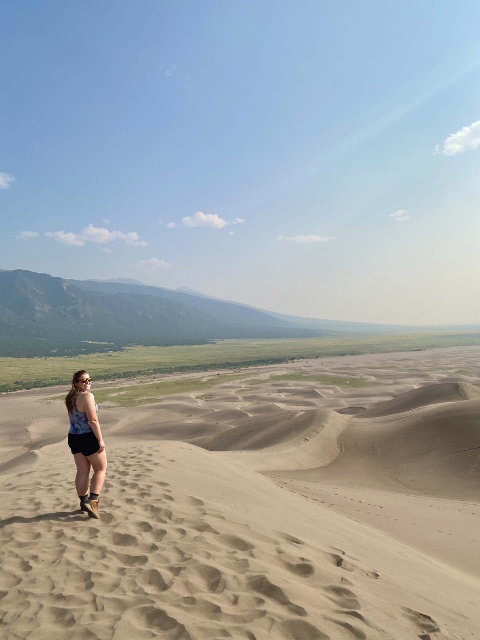
1. Great Sand Dunes National Park
We all know Colorado has the mountains, but sand dunes? And North America’s tallest ones at that?
In the southwest pocket of Colorado, in the town of Mosca, that’s exactly what you’ll find. A striking mountain range that serves as a backdrop to the sheer beauty of sand several hundred feet in the sky, seemingly out of nowhere.
There are three dunes that top all the others: High Dune, Star Dune, and Hidden Dune. For all three, park at Dune Parking just past the Visitor Center.
High Dune isn’t the tallest dune, but it is the quickest to get up. If you are only passing through the park, this is the perfect one to tackle. From the parking lot, head straight up the dunes. It’s a little under 700 feet and about three miles total.
Star Dune and Hidden Dune are the tallest – Hidden is slightly taller than Star. These two are longer treks (around 6-7 miles).
This park is one of the least visited (as are the other two on this list). In 2019, Great Sand Dunes had 527, 546 visitors. Obviously that number has risen with the increase of road trips and stateside travel, but it’s still nowhere near the looks of visitor numbers in popular parks.

Tips: Start early or go later in the afternoon. Sand can really heat up. If you’re into it, rent a sandboard from town to save yourself time once you hike up. There is a water station at the parking lot to rid yourself of sand. Though it might stick around for longer than you’d like!
Best time of year to visit: Fall or winter to see the contrast of the mountainscape behind the dunes. Summer brought welcomed warmth on a windy day at the dunes. You can’t go wrong!
Where to stay: The dunes can be a day trip, but if you want to take advantage of seeing the stars at night, I would camp within the park at the designated campground, Piñon Flats.

2. Black Canyon of the Gunnison National Park
The Black Canyon is one of the few places I’ve visited that left me in utter awe. This park truly is phenomenal. Located right by the charming, small town of Montrose, this park is a hidden gem. Considering it is one of the deepest canyons, it makes sense it isn’t visible to most people.
The drive in isn’t too captivating, but as soon as you stop at the first overlook, the jagged rock structures and sheer darkness along the canyon edges will surely give you a reason to not look away.

The Gunnison River in all its glory.
This park only had 432, 818 visitors in 2019. That blows my mind. There is truly something for every explorer at this park. World-renown fishing, incredible hikes, and stunning vistas.
I recommend driving down South Rim Road and stopping at each view along the way. Each trek is short and provides new angles of the canyon. I couldn’t get enough of its depth!

Tips:
Spend two days in this park. One day can be spent exploring all the overlooks and going on short hikes to see the true depths of this canyon. The next day can be spent with an obtained permit to go down into the canyon on the Gunnison route. This route is an incredible 2.7 mile hike with 1,700 ft elevation gain. The trail is minimally marked and a very limited number of hikers are allowed each day, fueling the intensity of this hike.

The first viewpoint from the entrance of the park opens up to this scaping view of the Black Canyon.
Best time of year to visit: Summer. This park is so infrequently visited that parking wasn’t an issue, neither was overcrowding at any lookout point. The roads are also closed in winter, so that’s something to keep in mind.
Where to stay: KOA in Montrose, CO. This KOA is very affordable and conveniently close to both the main street and the park. As with most KOAs, you can camp in a tent or stay in a cabin!
3. Mesa Verde National Park

These cave dwellings were built around the end of the 12th century. How wild is it that we can view (and walk among them) today?
I have had this park on my list from the beginning of my park journey. Famous for the cliff dwellings, this park was designated a UNESCO World Heritage Site in 1978. One of the first in the United States!
Despite how incredible this park is, only a little over half a million people visited in 2019 (556,203).
I did a self-guided exploration of this park for half a day, soaking in the cliff dwellings from every angle I could and from every lookout point possible. I suggest driving along the Mesa Top Loop. This road will give you access to neat stops like the Sun Point View and views of the cliff dwellings. If you’re short on time, definitely take a ride along this loop road to absorb as much as you can.

I love imagining what it would’ve been like to discover places like this (and Machu Picchu) for the first time. Here is a cave dwelling from an overlook point.
Tips: For guided tours, book in advance! There’s nothing worse than arriving at a new park, hopeful to see something, only to find out it’s booked. You can book your guided tour here.

Best time of year to visit: Almost every season. Seriously! I visited in August and never struggled for a parking spot. It’s very unvisited, which makes it quite the hidden gem. However, if you really want to take a guided tour, you need to visit May-October as they are not offered in the winter and spring months.
Where to stay: Cortez/Mesa Verde KOA Journey in Cortez, CO.
Have you visited any of these Colorado national parks? Which one is on your list?
Loved this post? Then you’ll love these:
Visit America's Newest National Park: The New River Gorge, WV
Experience the Best of Hawaii’s Haleakalā National Park

A Guide to Hawai’i Volcanoes National Park

My 32nd national park!
I knew the least about Big Island prior to visiting. All I knew was that Volcanoes National Park resided there, and so I needed to visit. That’s the beauty of wanting to achieve a list. Sometimes, in order to cross a place off, you find unexpected beauty. We stayed in this beautiful Airbnb off the grid right outside the park immersed in the rainforest. I highly recommend it if you’re planning to spend time at Volcanoes!
We headed into the park our first night, headlamps in tow. I usually try to limit my night explorations in unknown places, but seeing this park at nighttime is an absolute must.

The lava glow at Volcanoes National Park.
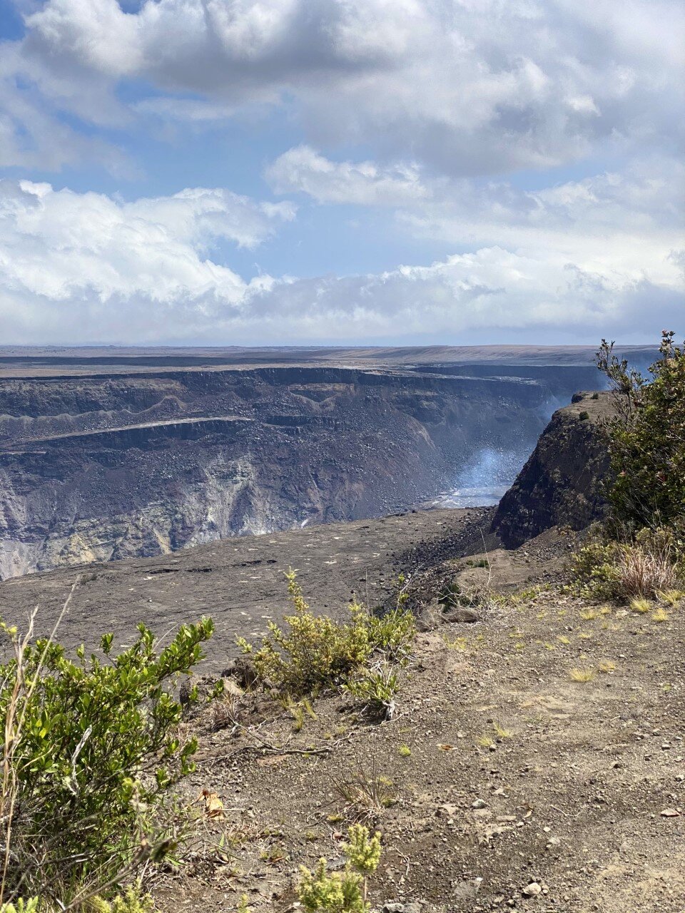
We drove into the park near the Kīlauea Visitor Center to explore the Kīlauea Overlook. The parking lot was nearly empty on this mid-April evening, and we walked the minute up to the overlook. We weren’t entirely prepared for what we were about to see, or in this instance, not see.
When researching this park, I knew an eruption occurred a few months earlier in December, and I was hoping to catch a glimpse of lava up close. I wanted the feel the radiating warmth of the lava against my skin, but instead I only felt the cool air bringing my body to a chill. If you make it out to this park at night, bring a jacket. Or two.
When we walked up to the Kīlauea Overlook, a hazy reddish hue like a gentle brushstroke of acrylic paint just touching the canvas for the first time caught our eye. “That’s it?” My friend remarked.
Instead of lava flow, we were met with lava glow. The glow appeared a deep orange and red blend on camera. A rarity for the picture to be more astounding than the image in reality. Below is the daytime view.
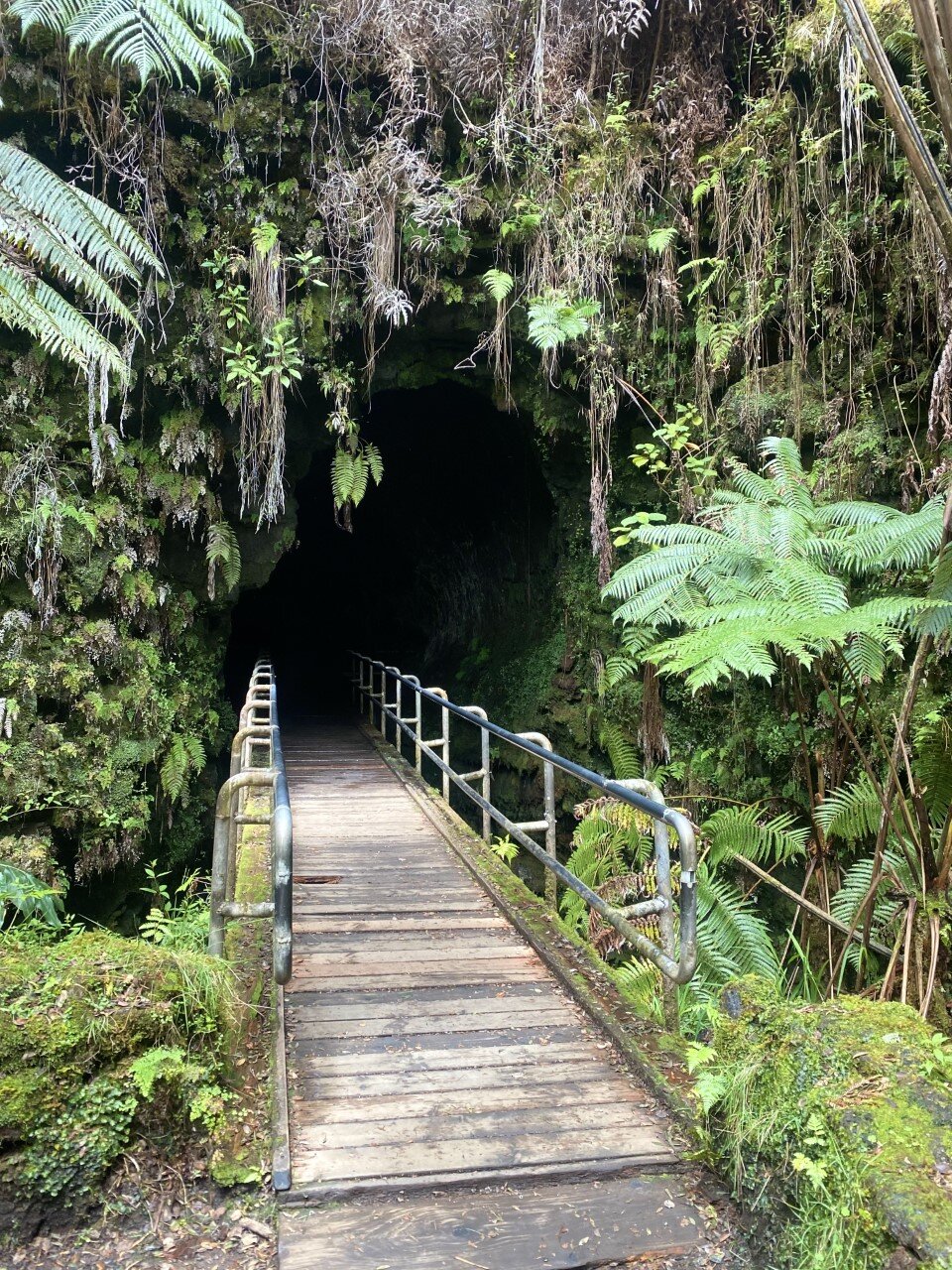
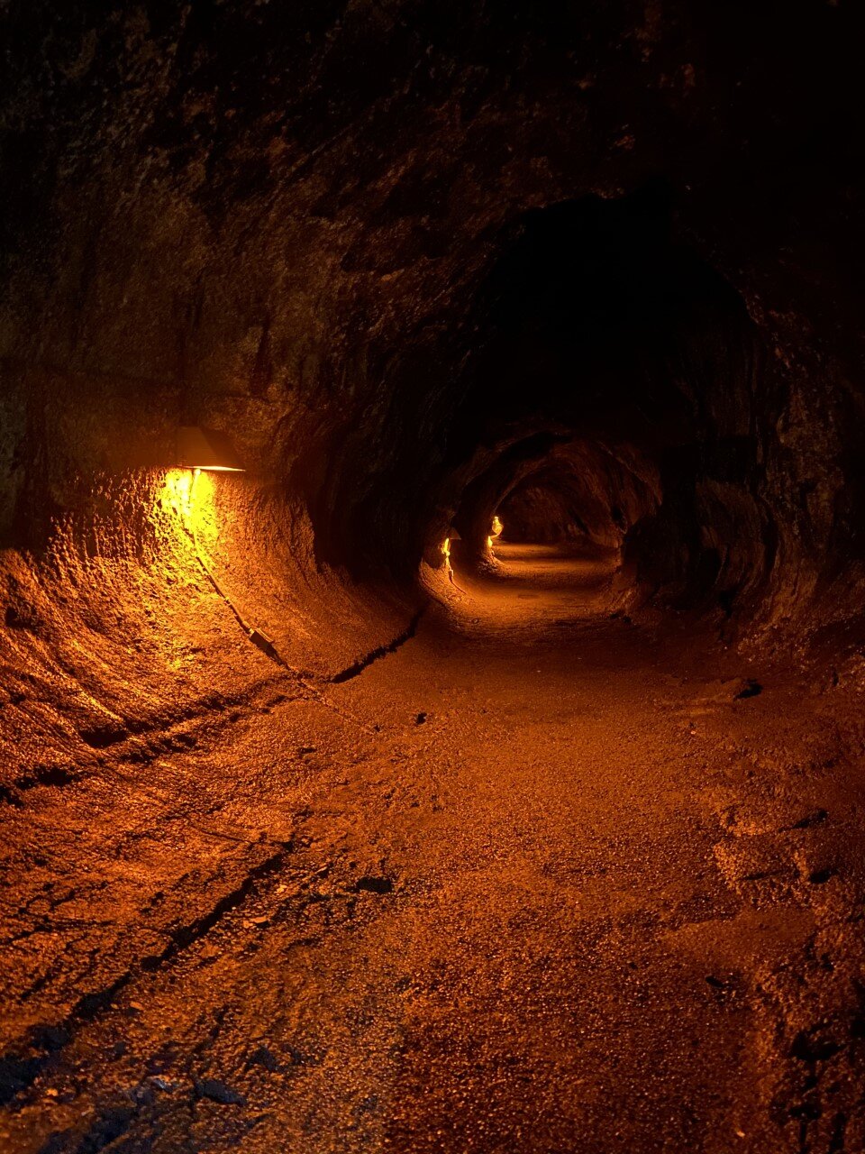
We explored the park in more depth the following day. We discovered another viewpoint at Volcano House that would be neat to see under a starry sky. We walked along the crater rim. Truthfully, I thought there would be hiking in this area, but all the sidewalks are very accessible and were all .2 or .3 miles of walking. Once we felt we had seen the crater enough, we drove onward to the Thurston lava tube. Another short traverse led us through a scenic rainforest and into a lit cave. At night, the lights are off if you want the full cave experience.

Across the street from the lava tube is a beautiful short trail as well with vistas of a crater floor you can actually hike down into and on!
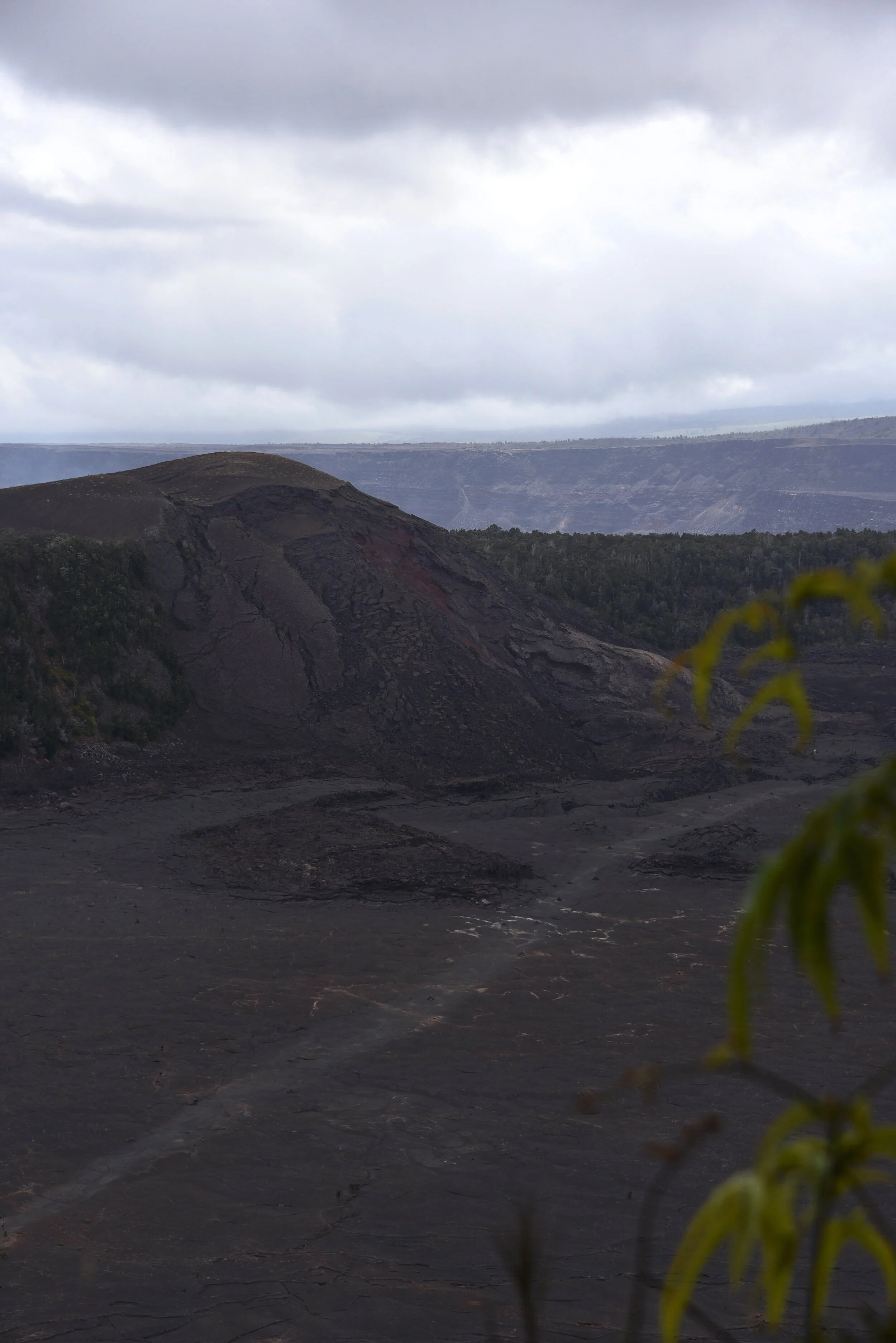
If I come back to Volcanoes one day, I would love to walk across the crater floor at the Kīlauea Iki Crater Overlook. It’s a 400 foot descent and a little over 3 miles of hiking down. The birds-eye-view is above.
We hopped back in the car and headed down the Chain of Craters Road – a road lined with lava rock. The final destination on this road would lead us to the ocean. I love variety in a national park and like Olympic in Washington, Volcanoes provided us with desolate, dark lands contrasted a few miles away with the glimmering ocean.
A .6 mile out-and-back along a road led us to Cliffs of Moher, Ireland views. Also known as the Hōlei Sea Arch on the Big Island. The arch formed from waves slowly eroding it, which is neat to consider it is constantly changing. This little ocean visit was a highlight of the park for me particularly because of the road to get down to it, and eventually, back up.

Hōlei Sea Arch at Volcanoes National Park
Our final adventure led us to the summit of Mauna Kea, one of Hawaii’s largest volcanoes. From its base underwater to the peak, it’s over 33,500 feet, meaning it’s taller than Mt. Everest (if you count what is submerged in water). Pretty neat, right?
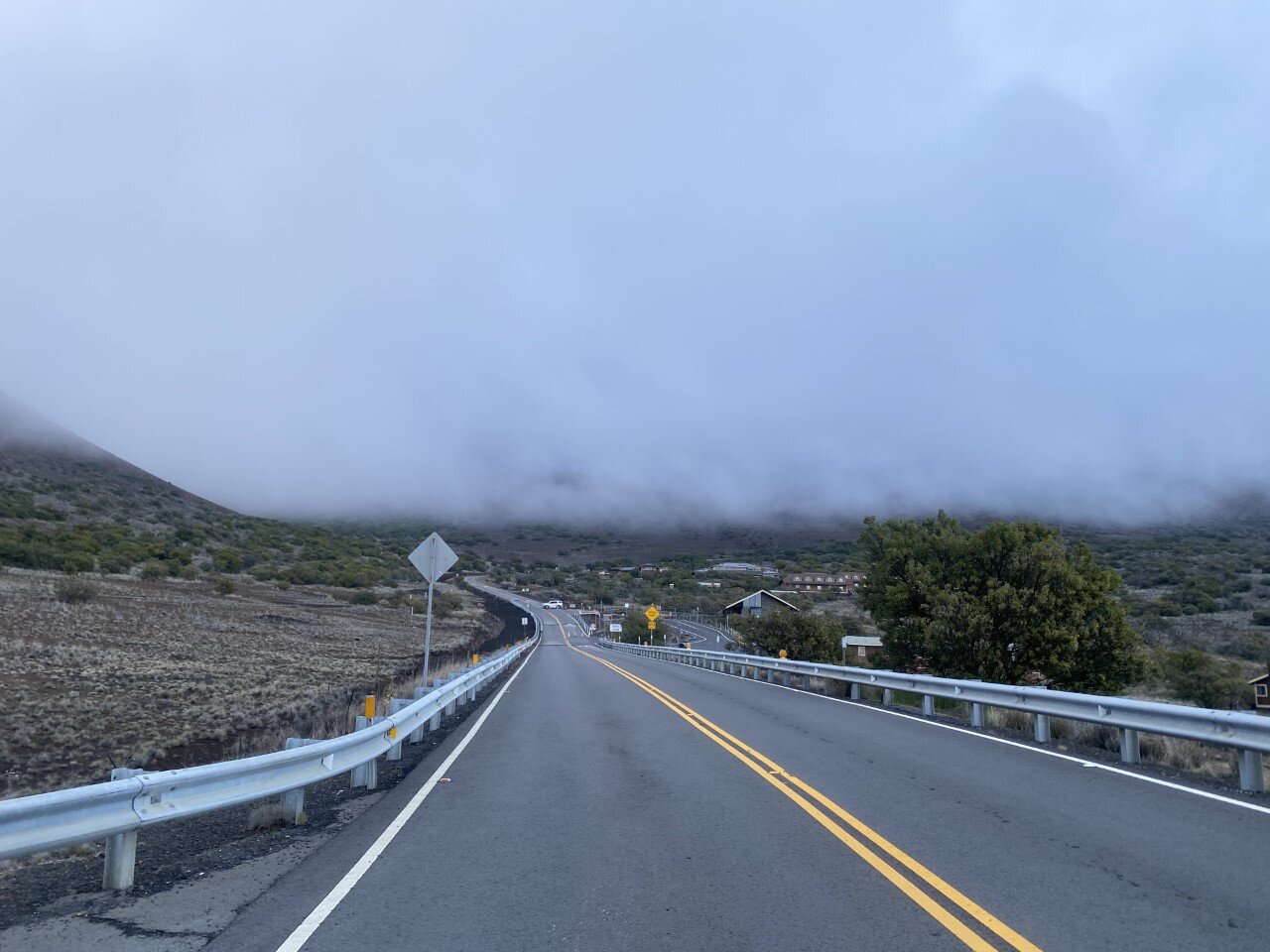
There is an observatory 13,803′ feet up to watch the sunset from. We made it up 9,000 feet where we were met with this worrisome sign (the eerie fog didn’t help) and a guard along the road.

And to think, we were just by the coast with the ocean breeze.
We drove from sea level to this point in about an hour and a half, so the sign makes sense. The remainder of the road can only be traveled with AWD, and most rental car companies won’t cover the damage from this road specifically.
The ominous road that leads to the guard checking if you have AWD or not.
So here’s the sunset from our little spot 9,000 feet up in the sky.

Our sunset above the clouds, but still a few thousand feet below the summit.
Did you have Volcanoes National Park on your list of places to visit? What part of the park can you not wait to explore one day?

Three Must Visit Lakes in the Grand Tetons
When we first planned out our trip to Grand Teton National Park, I was stoked to find out there were several short hikes. From taking a gander at Jenny Lake, to short walks, you are bound to enjoy your time in the Tetons no matter how you spend your time.
The best part? The Tetons also have an incredible bike path (very few national parks do) that takes you from Jackson Hole into and throughout the park. The bike path is paved and lengthy, ending at Jenny Lake. You can also continue along roadside. We were thrilled.

We parked inside the park and biked from there. We brought our own bikes, but there are several places in town to rent from. If cycling isn’t your thing, you can also explore these scenic lakes by foot or by car.

Check out the three lakes I recommend spending your Teton time at:
Taggart & Bradley Lake
Taggart and Bradley lake are everything you imagine about the Tetons and more. As soon as you park at the trailhead, you are greeted with inspiring views of the Tetons. Just the trailhead parking lot alone is a sight to take in. Arrive early because this parking lot caters to hikers of all types: those who are tackling the grands, those who are going for a leisure stroll, and those who needed a quick pee stop.
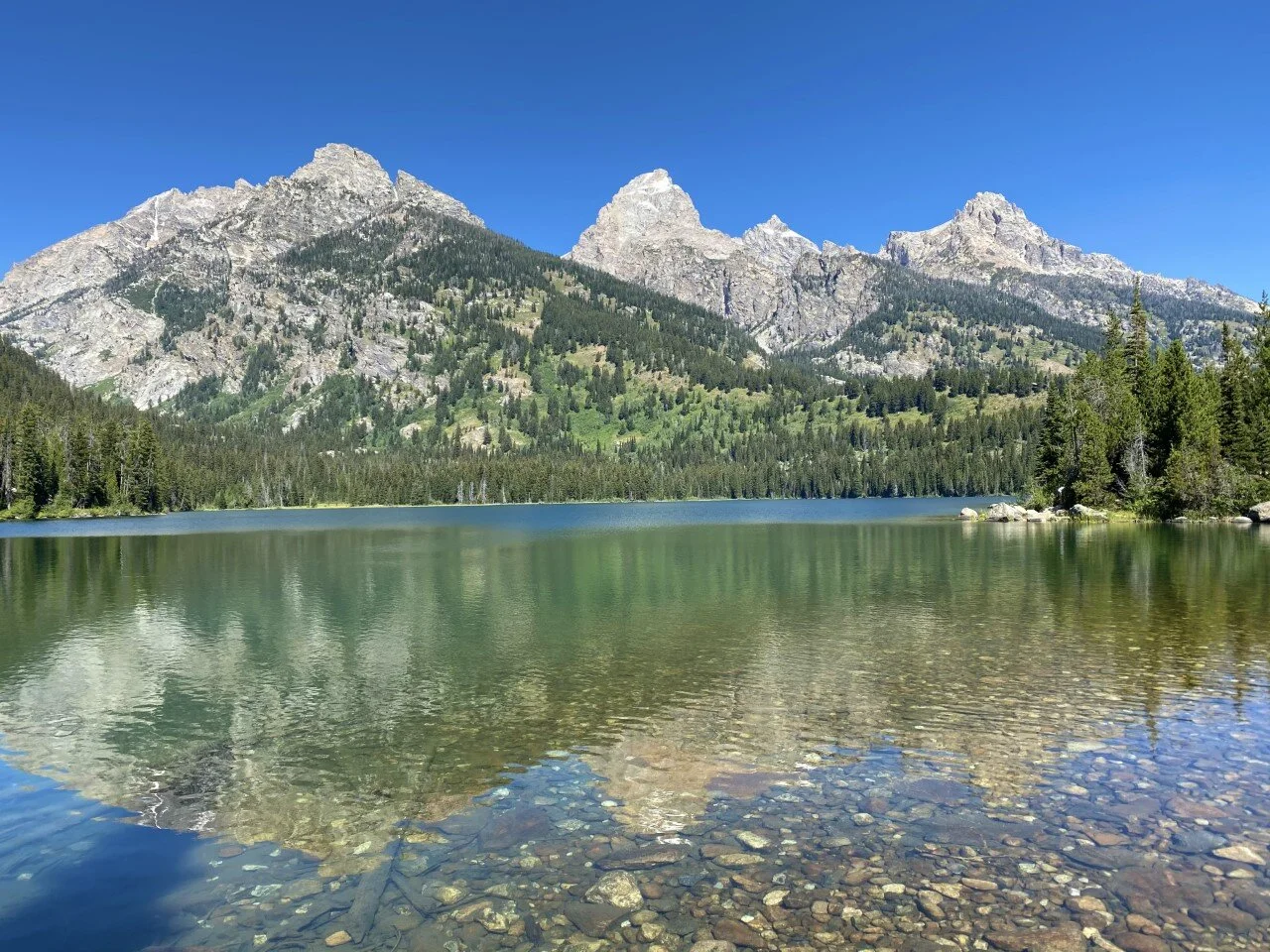
We scored the last available parking spot at the Taggart Lake Trailhead (only a few miles in from the national park entrance) and began our hike to Taggart Lake. At a little over two miles, while gazing almost entirely at the Tetons above, we reached Taggart Lake.

Another 1.5 miles on the trail led us to Bradley Lake, which was easy to miss at the junction. This lake was less crowded, and just as stunning as Taggart. A little over two miles led us to complete the loop at around 5.5 miles and 500 feet elevation gain total.

Jackson Lake
This national park is quite large, but we were determined to see as much of it as we possibly could. From hiking to a couple lakes, to biking alongside the road, we also explored the northern part of the park by car. This drive brought us to Jackson Lake, where the summer blue sky seamlessly blended into the shimmering crystal waters.

I could stare at this view forever. It’s the perfect spot to eat your packed lunch, stop for a break, or simply relax. Plenty of viewpoints to pull over for with ample parking to take in this dreamy view.
What’s your preferred way to see the lakes - bike, hike, or drive up to the view?

Best Day Hike in Glacier National Park
Glacier is Montana’s gem. Truly. From the summer wildflower fields to the grazing wildlife, to the glaciers. Oh my goodness the glaciers! I left part of my heart in Glacier and I cannot wait to go back.
With initial plans to hike to the Grinnell Glacier, only to find out the night before that that part of the park was closed (summer 2020), we swiftly searched our NPS map for other hikes. The maps that the park service provides are jampacked with information about wildlife need-to-knows, safety measures to take, and hikes to explore. I highly recommend grabbing a map when you arrive (or check out GNP’s breakdown by regions of the park here).
Turns out, Grinnell Glacier can also be reached from the skies. Lucky me! Instead of reaching the glacier from the ground-level, we’d be hiking up to the lookout spot surrounded by the peaks. In hindsight, part of the park’s closure worked out in our favor because I never would have experienced this trail otherwise.
We set out early in the morning. Early in Glacier summers means 3:30 or 4am with the peak tourism. You would think a park in the furthest part of Montana would be kept as a hidden secret, but alas, the secret’s out. Glacier is a gem no one wants to miss out on.
With only one road to the trail’s access point, we quickly found ourselves in traffic. Shuttles that usually run throughout the park were shut off. Parking was full at Logan Pass, but we were fortunate to snag a spot half a mile away alongside the road in a designated parking spot.

Hiking along the Highline Trail…
Moments later, we embarked on the Highline Trail and I kid you not, every step had mountainscape views. Wildflowers and even some wildlife (deer, marmots, and mountain goats) along the trail as well. My first experience with a marmot is one I’ll never forget. As soon as I set my eyes on this adorable, sunbathing creature, a screech was let out that sounded like someone was being attacked. Turns out this adorable little thing has a fiery side to him. We quickly hiked on.

Even if you only have a couple hours to spare, hiking the Highline Trail is completely worth it. We gave it the day to see the glacier, so we made our way up the majority of the hike’s ascent to the Grinnell Glacier Overlook. The sign lies to you when it says .6 miles away. Trust me.


Closer to a mile of what felt like an endless uphill, we reached shimmering, aqua blue waters outlined by ice. It looked surreal.

With time to spare, we decided to make our way to the Granite Park Chalet, not too far from the start of the ascent to the glacier overlook. Glacier originally had over ten chalets built to mimic the vibe of Switzerland – ultimately, to promote tourism. Why go to Switzerland, when you can have it all right here in Montana? Sadly, various situations led to many of them no longer standing. The Granite Park Chalet is one of two remaining in the backcountry.

The views from this chalet are phenomenal. The fact that this trail is extraordinarily stunning and leads you to a homey chalet just tops it. Bookings fill up swiftly, for good reason, so plan ahead if you’re hoping to snag a spot at this dreamy stay. We did an out-and-back from the chalet, adding up to 3,700 elevation gain in 18 miles of trekking.
The Granite Park Chalet also has a campground below it, not too far away. It’s the perfect entry into the backcountry if that’s your thing. My heart was completely full after this hike. If you only have a day to devote to hiking, this is your trail for a taste of all the delights that Glacier offers.


How to Plan Your Trip to Yellowstone National Park

Driving east through Wyoming would never give you the impression that it is home to one of the U.S.’s most fascinating and largest national parks: Yellowstone. It’s where Montana’s forest green meets Wyoming’s Wild West. Western Wyoming, on the other hand, looks much like the Wild West in your head, solely missing the tumbleweed rolling slowly across the one-lane “highway.”
Needless to say, western Wyoming was one of those long stretches of road where you aren’t sure if your car will make it on your current tank of gas before you see another gas station (or any sign of life, really). If I haven’t convinced you yet to visit Wyoming, just wait. When you reach the little pocket of northwestern Wyoming, you’ll feel transported to another world. Seriously, Yellowstone felt otherworldly.
We spent a couple days in the park absorbing as many geysers, hot springs, and wildlife viewing as possible. We spent a great amount of time driving from destination to destination. It felt like navigating through an IKEA with all of the stops on the map that we wanted to explore.
Check out the map below from the National Park Service and you’ll see what I mean. There are miles upon miles between each destination region– almost like the kingdoms at Disney World, except it’s more like nature’s amusement park. Summer in Yellowstone feels similarly to a summer trip to Disney World – crazy crowds (and cars) everywhere.

We split up the park into sections to take on to get the most out of our days. With summer travel plans coming into fruition and you find adding the northwestern pocket of Wyoming on your list, here’s how to make the most of Wyoming’s Wild West.
Divide the park into these three sections to see all the fascinating beauty Yellowstone has to offer:

1. Canyon Village
Canyon Village contains the Grand Canyon. Not to be confused with the Grand Canyon down in Arizona. Also for East Coasters, this is not to be confused with the Grand Canyon of the East in Letchworth State Park in New York.
Mt. Washburn was on our list to hike in the Canyon Village area, but its location put it right in the middle of a road construction project. If that’s the case for you, it’s still worth exploring this section of the park. Places to see: The Grand Canyon of Yellowstone, Artist Point, and the accompanying Falls (Lower and Upper).
These scenic viewpoints are all very short, well-marked trails that work for all types of hikers. A bonus if you’re heading back south is Hayden Valley.
Bring your binoculars because wildlife love the vastness of this valley, especially when dusk starts to set in. If you forget about this tip, you’ll see loads of cars parked alongside the road to remind you to keep your eyes peeled.


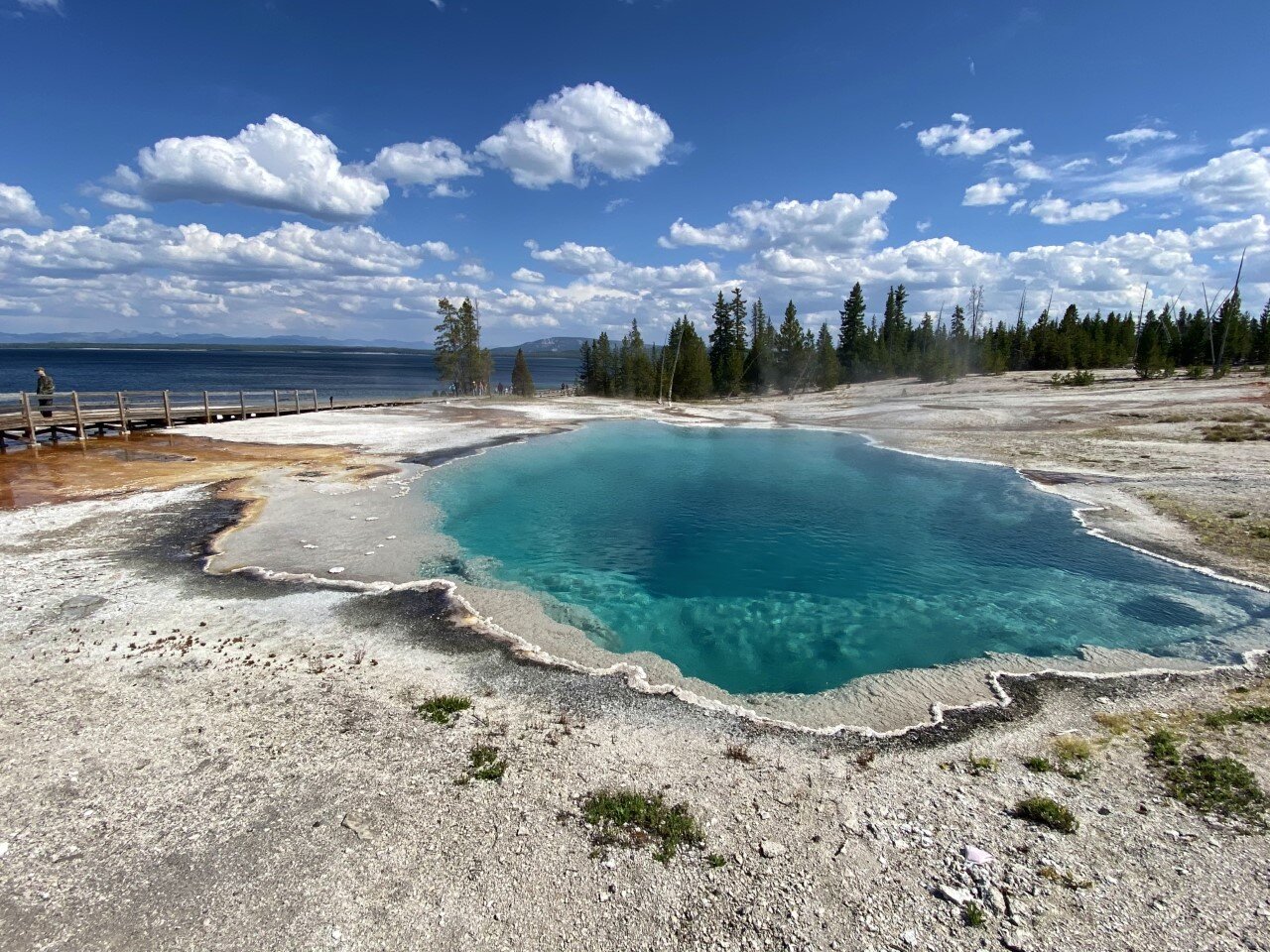
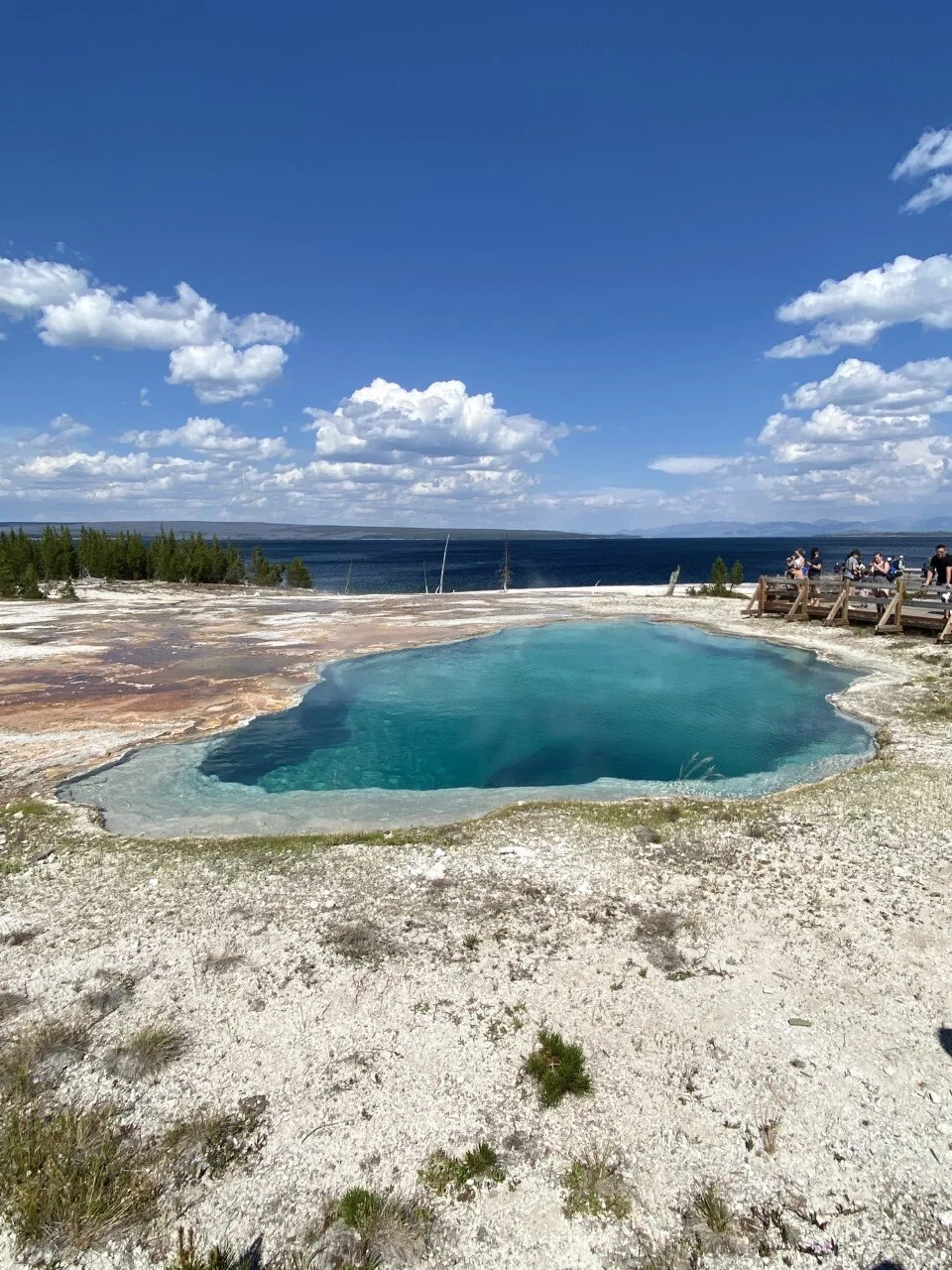
2. Old Faithful and West Thumb/Grant Village
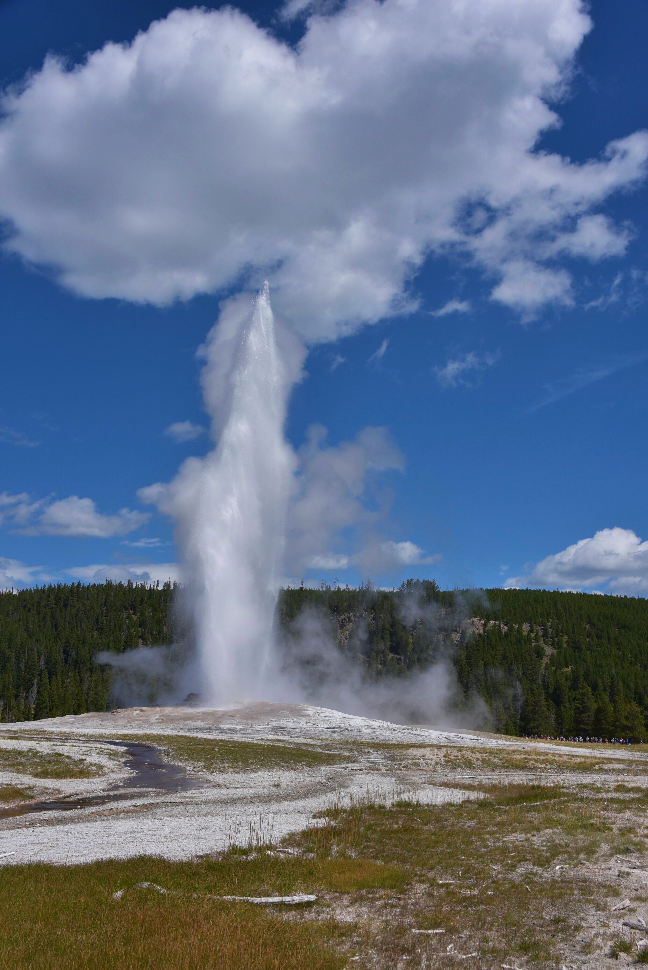
With our map in hand, we embarked on a self-guided geyser tour through the heart of Yellowstone National Park. We spent a day going from geyser to geyser. We made our way first to Old Faithful — given that it’s the most popular (and named appropriately). The park gets the timing of this geyser narrowed down to a small window, so you won’t need to waste time waiting for it to erupt. It’s quite the spectacle.
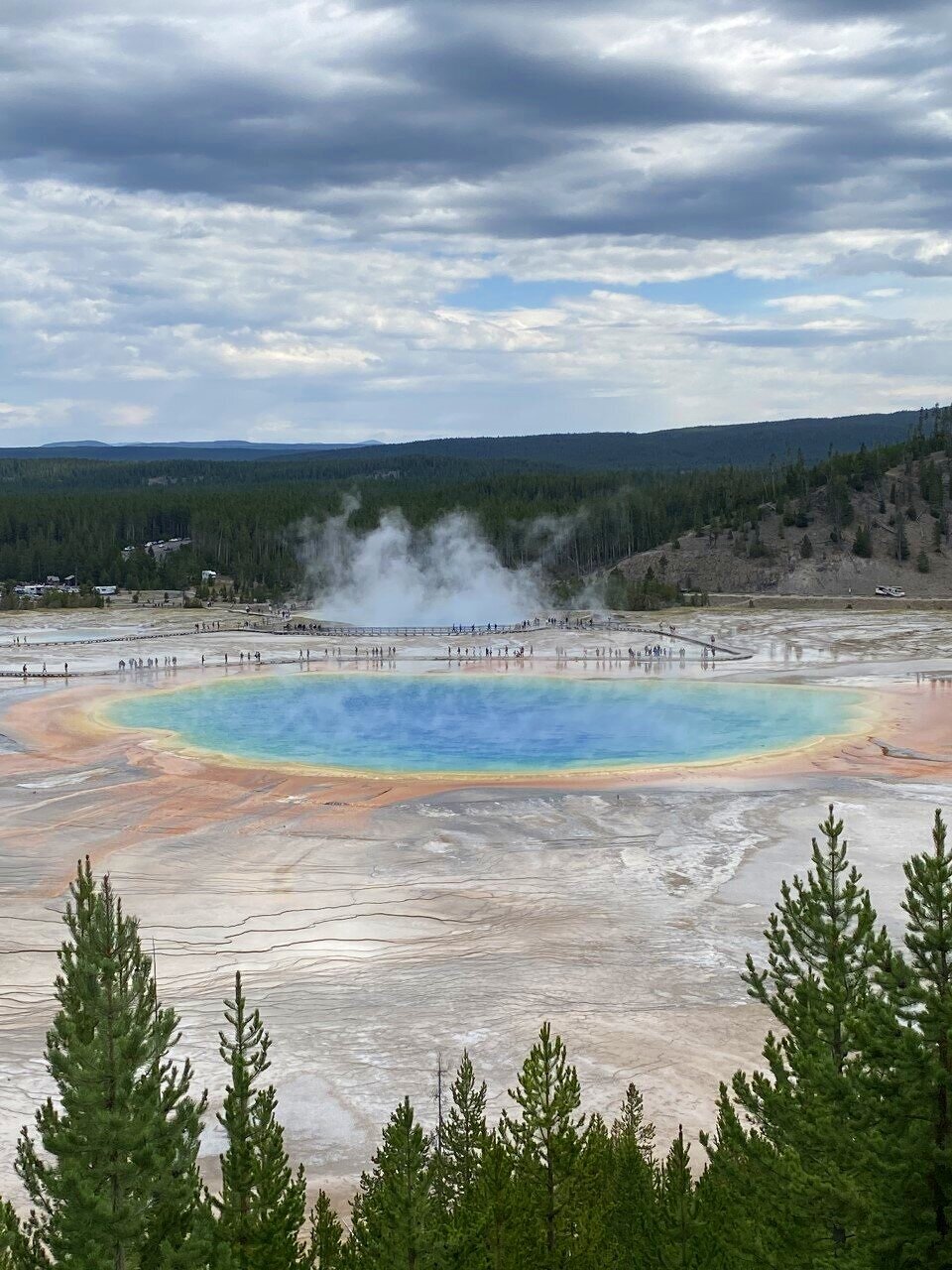
After Old Faithful, we explored the Upper Geyser Basin, Lower Geyser Basin, Black Sand Basin, Biscuit Basin, and West Thumb Geyser Basin (pictured below. I told you – a great deal of geysers. Turns out, Yellowstone is home to over 10,000 geysers, hot springs, mud spots, and the sort. Each of these geyser basins takes about a half hour or less to walk around and explore.
The Grand Prismatic Spring was well worth the view. We gave this one a little more exploration time. Parking here was also limited, but spots opened up quickly as the walking loop to view the spring isn’t long.

3. Mammoth Hot Springs
This northern part of the park was way quieter, which might be why it was my absolute favorite. Like I said earlier, I’m a tourist, but I’m not a fan of hoards of tourists. I love the local feel (hard to come by in the heat of summer in America’s first national park).
The Mammoth Hot Springs Terraces are a small point on the large map. In a matter of steps, you are viewing jagged, salt-like walls with Montana in the north. I felt transported back to Peru’s salt mines in Maras with the coloring of the limestone in a desert-like landscape. This part of the park is also “near” Lamar Valley, another massive valley ideal for spotting wildlife. We ran into multiple bison jams here.
Is Yellowstone National Park on your list yet? What spot do you want to see the most?